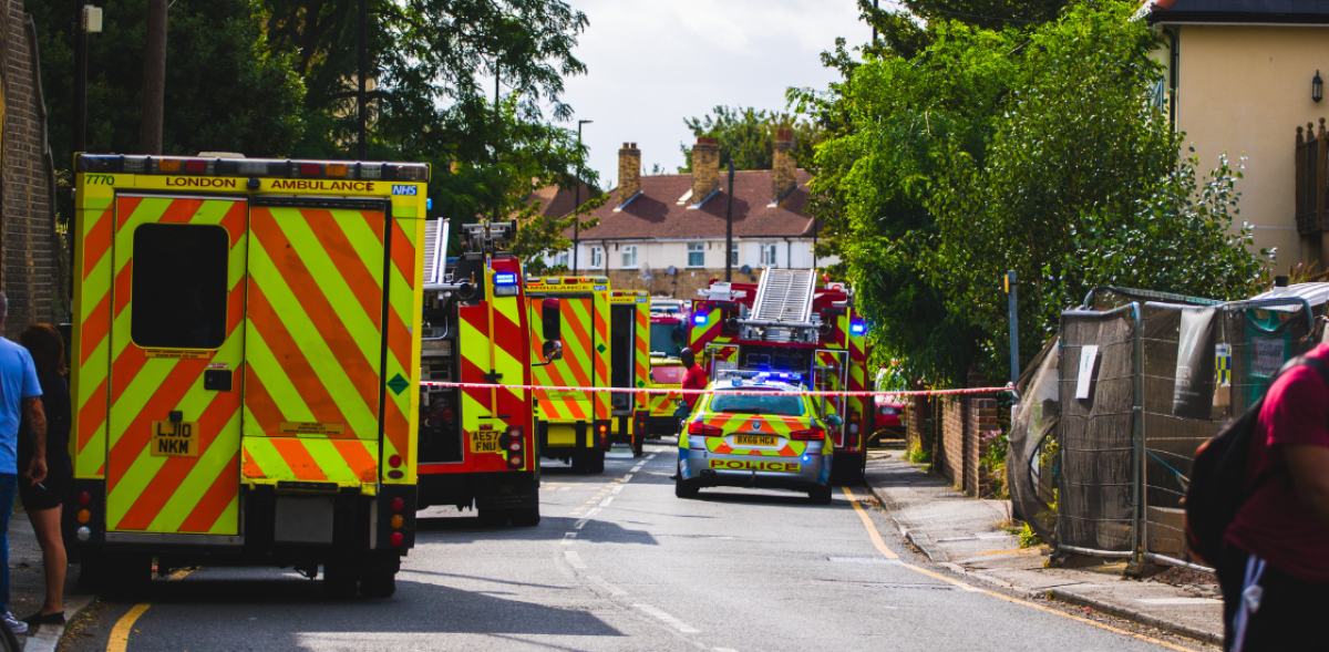
Most incidents don’t fail because agencies lack resources. They fail because units, dispatchers, and command staff are working from different versions of the same event, one radio report ahead or behind everyone else.
In this article, we’ll break down what a common operating picture actually involves, what tends to go wrong without one, and which tools and workflows make a real common operating picture possible in the field.
Table of Contents
What a Common Operating Picture Actually Is
A common operating picture is a single, continuously updated view of an incident that every responding agency can see and trust at the same time. It’s a core concept in emergency management, and it plays the same role in incident management whether the incident involves one unit or a dozen.
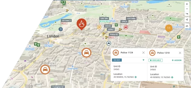
A common operating picture pulls together unit locations, resource status, and hazard information from multiple sources into one shared reference point, rather than being tracked separately by each of the organizations involved. It’s not one map or one dashboard. It’s a working picture that lets different units within the same operational environment see the same facts, updated at the same pace.
The distinction worth holding onto: situational awareness is what one agency knows. A common operating picture is what everyone knows, at once.
The Cost of Operating Without a Common Operating Picture
When agencies don’t share a common operating picture, the effects show up in almost every part of a response.
Response gets slower. Without real time information about what’s already been assigned, dispatchers and commanders lose time confirming information by radio or phone instead of acting on it. Decisions that should take seconds, redirecting a unit, expanding a perimeter, calling in mutual aid, get delayed by a round of calls just to check what other agencies already know.
Responder safety takes a direct hit. If one agency doesn’t know where another agency’s units are operating, the risk of friendly-fire incidents, crossed paths during pursuits, or crews entering a hazard zone without warning goes up. A common operating picture is as much a safety tool as a coordination tool, and its absence is a safety gap, not just an inconvenience.
Resources get used inefficiently. Without visibility into what other agencies have already committed, it’s common for multiple units to converge on the same low-priority call while a more urgent one goes unstaffed. Mutual aid units arriving from outside the jurisdiction often start from zero, with no shared record of the incident to work from, which slows coordination and their integration into the response.
Command decisions get made on incomplete or outdated information. Every agency working from its own version of events means the incident commander is reconciling conflicting reports instead of directing a response. That usually means decisions get revised mid-incident, which costs time and can undermine confidence in command.
Public communication becomes inconsistent. When agencies don’t share the same facts, they tend to give the public different instructions, evacuation guidance, road closures, shelter locations, at the same time. That inconsistency erodes public trust exactly when clear direction matters most.
Accountability gets harder after the fact. Without one continuous, shared record of the incident, after-action reviews take longer and turn up more disputes, since investigators have to reconcile separate logs from each agency instead of working from a single timeline.
None of this requires a large-scale disaster to matter. These same gaps show up in routine multi-unit calls, just at a smaller scale, and they compound as an incident grows.
What Changes When Every Agency Sees the Same Information
When agencies work from one shared, current view of an incident, the practical effects show up fast. Dispatchers can allocate the nearest available unit instead of the next unit in a queue, because they can see what every agency already has committed. Incident commanders can adjust a perimeter or evacuation zone without waiting for a radio relay to confirm what other agencies are doing on the ground. Mutual aid units arriving from outside the jurisdiction can be integrated into the response immediately, because they’re seeing the same data as everyone already on scene, not starting from zero. That kind of real-time allocation is exactly what a dispatch management system is built to handle, matching the closest available unit to a call as conditions on the ground change.
The result is shared situational awareness, not just for command staff but for every unit operating on scene. Safety improves too. Knowing where every unit is, in real time, cuts down on the kind of friendly-fire risk that shows up in structure fires, active shooter responses, and multi-agency pursuits. And because a common operating picture is a live record, not a collection of individual notes, after-action review becomes faster and more accurate.
None of this requires agencies to merge their systems or give up jurisdictional control. It requires the data each agency already generates, unit status, incident reports, resource availability, to reach a shared layer that everyone with the right access can see.
Tools Behind an Effective Common Operating Picture
A common operating picture is built, not switched on. It comes from several categories of tools working together and feeding the same shared layer:
| Tool Category | What It Contributes |
|---|---|
| Computer-aided dispatch (CAD) | Live unit status, call assignments, and incident records shared across agencies |
| Automatic vehicle location (AVL) / GPS tracking | Real-time position of vehicles and personnel on the map |
| Interoperable radio and communications gateways | A shared channel across agencies using different radio systems |
| GIS and mapping layers | Hazard zones, evacuation routes, infrastructure, and terrain data overlaid on the same map |
| Incident and resource management software | A running log of resource requests, assignments, and availability |
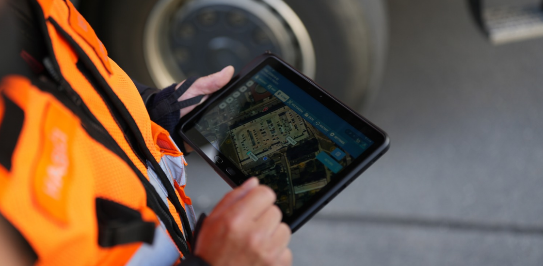
| Mobile data terminals | Field access to the shared picture for units that aren’t at a fixed command post |
Asset tracking is a good example of how this comes together in practice. A tool like Tactical AVL feeds live vehicle and personnel location into the shared picture, so command staff and other agencies see where units actually are, not where they were dispatched an hour ago. Building this out also means being deliberate about who can see sensitive information within that shared layer, since not every data feed needs to reach every agency in full detail.
The point isn’t to collect every possible data feed. It’s to make sure the feeds that matter for a given incident type land in a place every relevant agency can actually see.
How Smart CAD Fits Into This
Dispatch is usually where the common operating picture either comes together or falls apart, since it’s the system that already tracks unit status, call assignments, and incident details in real time. Smart CAD is built around that role, centralizing the data every responding agency needs into one shared view. Relevant features include:
- Real-time unit location tracking on an interactive map, visible to every connected agency, not just the one dispatching
- Machine-learning-based resource allocation that suggests the closest available unit based on live status, not a fixed rotation
- Shared incident and case records, with real-time updates as status changes in the field
- Two-way communication logs that timestamp every exchange between dispatch and units, creating a single record instead of separate notes
- Live video and CCTV feed integration, so command staff and other agencies can see field conditions directly, not just hear a description of them
- Map annotation tools for marking hazards, evacuation routes, and points of interest that every connected unit can see
- Mobile access for field units, including secure messaging and live mapping, so the shared picture isn’t limited to a fixed command post
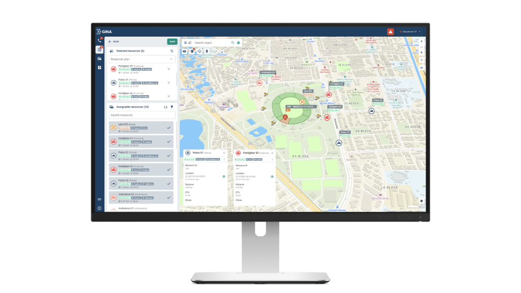
In practice, that means a mutual aid unit from a neighboring jurisdiction can be dispatched and tracked inside the same system as the home agency’s own units. It means an incident commander can see resource availability across agencies without a phone call to confirm it. And because Smart CAD keeps a continuous record of assignments, status changes, and communications, that same data supports after-action review once the incident is over, without anyone having to reconstruct the timeline from memory.
That’s the practical version of a common operational picture: not a standalone display, but a dispatch and coordination layer that every responding agency is already using.
Conclusion
A common operating picture isn’t a reporting tool you add once an incident is underway. It’s built from the systems agencies already rely on, dispatch, tracking, communications, and mapping, connected so that the information one agency has turns into a shared understanding every responding agency can act on. The incidents that go wrong tend to share one trait: agencies had resources but not a shared picture of how to use them. The ones that go right usually don’t have better luck. They have better visibility, built in before the call comes in.
If your agency is looking at how to close that gap, request a demo to see how Smart CAD supports shared visibility across dispatch and response.