

Smart City Software
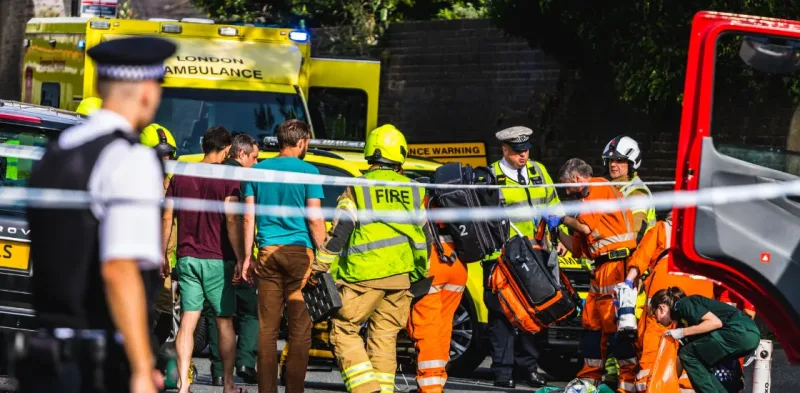
Coordinate police, fire, and EMS across the entire city with real-time visibility, unified dispatch, and shared incident management. Smart CAD keeps every safety agency aligned so response is faster and no incident falls through the cracks.
Trusted by first responders


Why GINA Software?


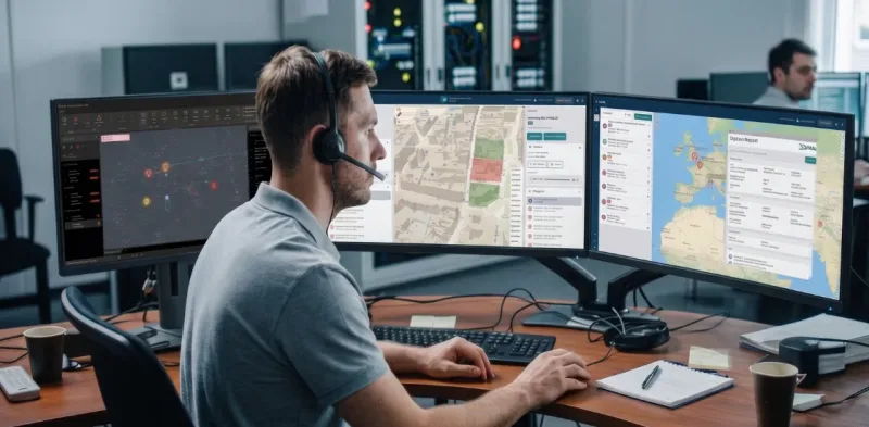
How Smart CAD supports safer city operations
Faster response
Every second between a call and a dispatch counts. With a unified operational picture and automated workflows, the right units reach the scene faster, regardless of which agency is responding or where in the city the incident occurs.
Always aligned
Fragmented communication between police, fire, and EMS costs critical time and creates dangerous blind spots. A shared incident view keeps all teams working from the same information, so handoffs are clean, coverage is continuous, and nothing gets missed.
Data-driven decisions
City safety leaders need more than gut instinct to allocate resources and plan coverage. Smart CAD captures operational data across every incident so commanders and managers can act on facts, not assumptions.
See why agencies like yours choose Smart CAD

Sygic
Partnering with solution providers, such as GINA, who create products that truly answer the needs of people and communities has been pretty amazing. Seeing how technology makes a difference in the real world is why we do what we do. And the results speak for themselves.

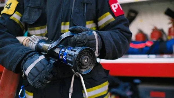
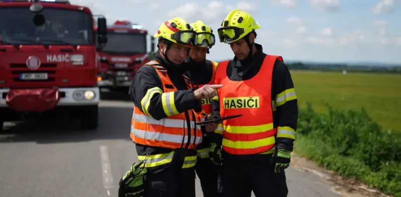
Fire Rescue Service of the Czech Republic
GINA significantly improves the efficiency of both routine and special operations, reduces arrival time, provides real-time information support, and increases the level of cooperation among all responding units. Thanks to technology we can react flexibly to altering situations in the field.
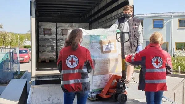
Czech Red Cross
Many of our members are volunteers who go out from their homes to the scene. At a time like this, it’s great to have an app that lets you see on a map how people are converging on the scene. You can then coordinate much better, for example, by talking to drivers.

GM Risk Group
We have been working with GINA for a few years now and have found the software solutions to be a functional tool for our teams on the ground, plus a value add to our clients through our increased service capabilities. GINA provides our team and clients with high-level situational awareness by allowing us to tailor how we integrate, manage and share intelligence that is relevant to our teams and task objectives.

Alpha 6 Canada
I was looking for a solution that would handle tracking as well as incident command and I found that in GINA. We can send messages, set up geofences, track our assets and it has good app that goes with it for the smartphone for our clients. GINA provides a lot of things for us. It brings a lot of things together – the tracking, the messaging and then the reporting.
G2S Group
GINA has been our partner for the past two years in creating and implementing new and tailored systems for our Security company. We are also a business partner for them in the Horn of Africa region as both Facilitator and Reseller for GINA Software in Public Safety, Defense and Security, and Oil and Gas. They are reliable, thorough, smart, available, excellent communicators, and friendly! As a Partner of GINA’s solutions, we’ve obtained a broad positive reception, and allows us to meet the clients’ requirements successfully.
Built for the demands of modern city safety
Smart call taking and dispatch
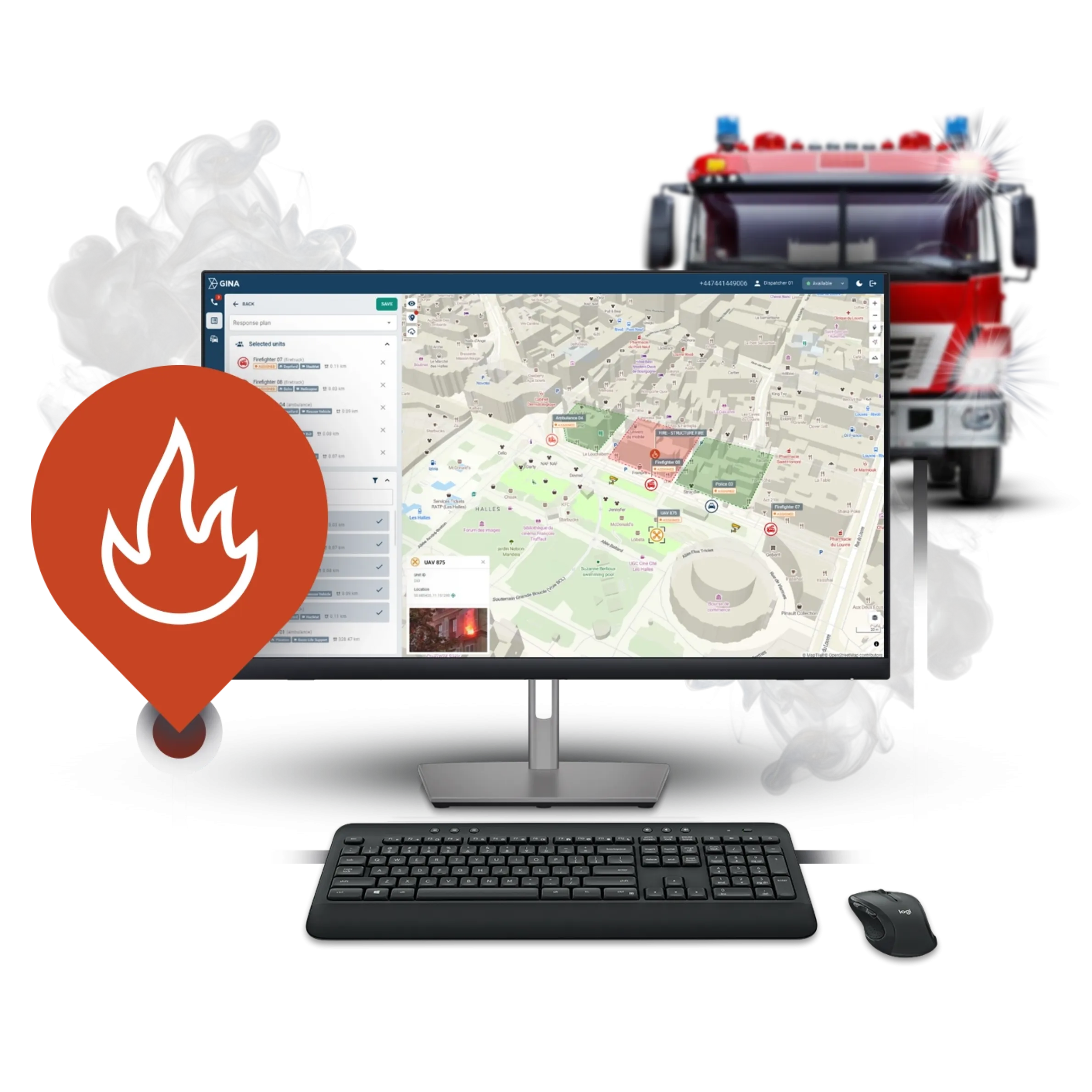
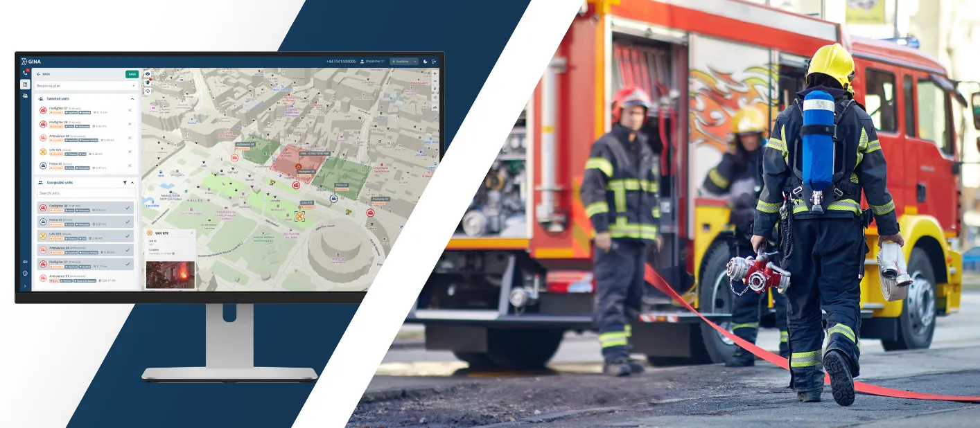
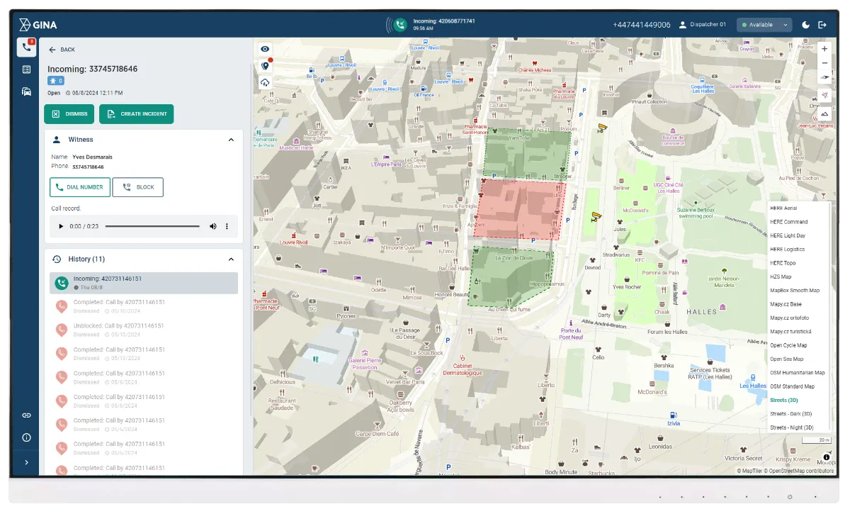
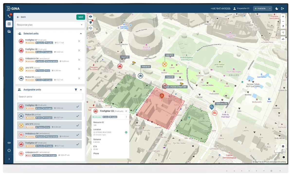
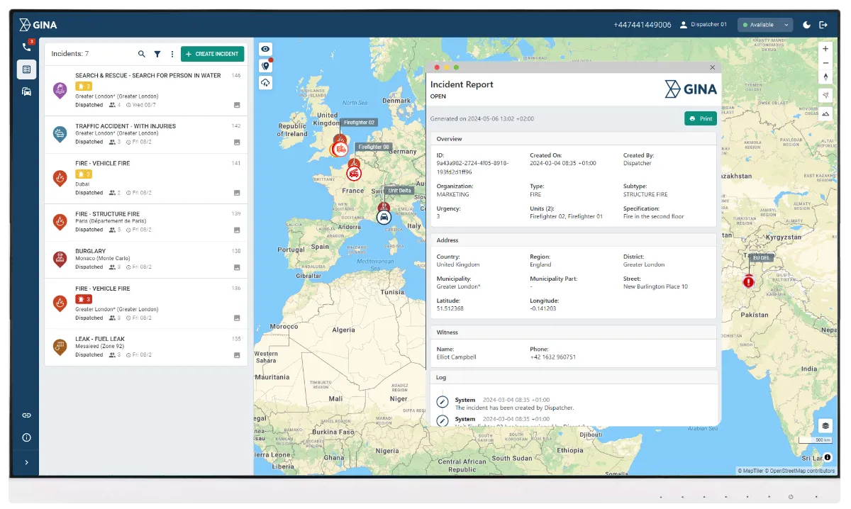
Handle every incoming emergency call and deploy the right resources across the city from a single, modern interface. Smart CAD automates routine dispatching tasks, matches incidents to the closest available units, and reduces the time between call receipt and unit deployment. Whether it is a police response, fire alarm, or medical emergency, every call is processed through the same structured workflow so nothing is missed and response is always fast.
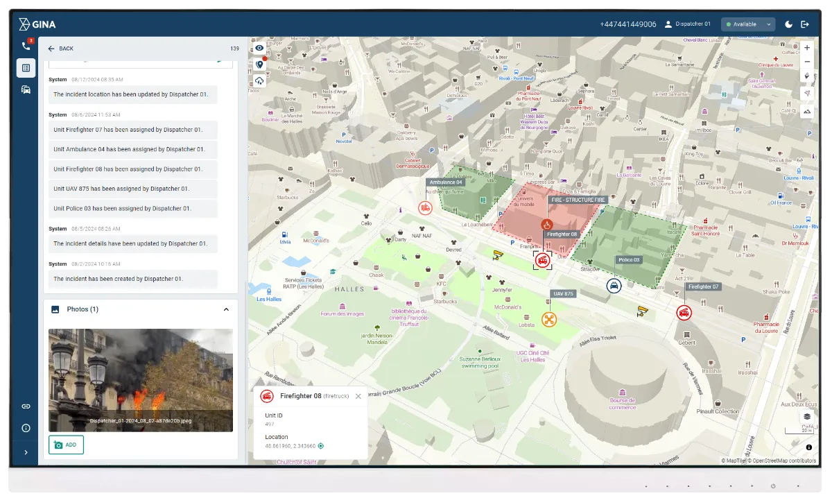
Multi-agency coordination
City emergencies rarely involve just one agency. Smart CAD creates a shared incident environment where police, fire, EMS, and municipal teams all work from the same live data. Tasks are assigned, status updates flow to every involved party, and decisions are logged centrally so coordination stays tight from the first notification to the moment an incident is closed.
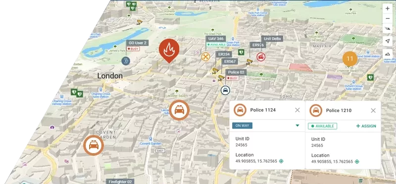
Live tracking and zone management
See the real-time position of every unit, vehicle, and asset across the city on an interactive map. Define operational zones around critical infrastructure, public spaces, and high-risk areas so the right teams are automatically alerted when an incident occurs inside a monitored area. Points of interest give dispatchers immediate spatial context, helping them make faster, better-informed deployment decisions across large and complex urban environments.
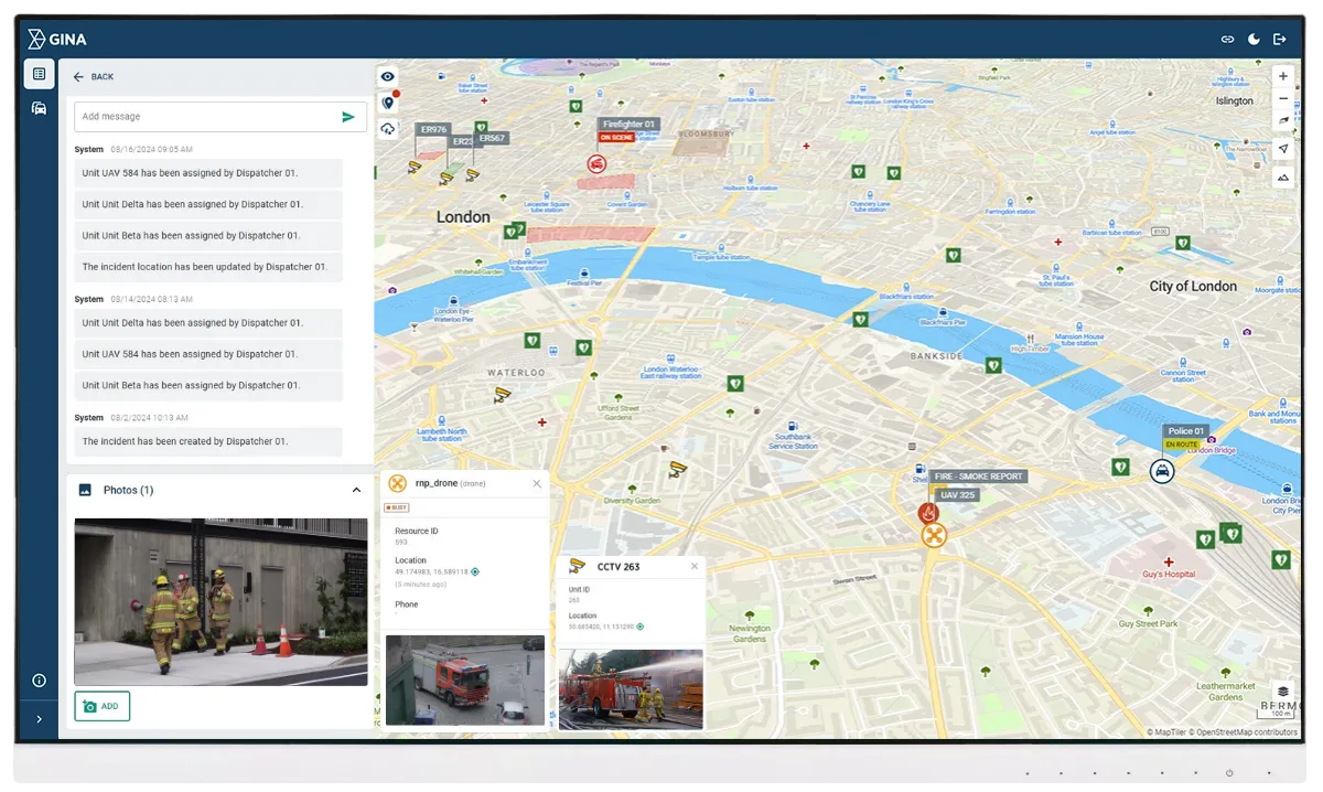
CCTV and drone integration
Connect live video feeds from city cameras and drone units directly into the dispatch environment. When a call comes in, dispatchers and commanders can verify the situation on the ground before units arrive, reducing unnecessary deployments and improving response accuracy. Video feeds are linked to active incidents so every relevant visual record is captured alongside the operational log.
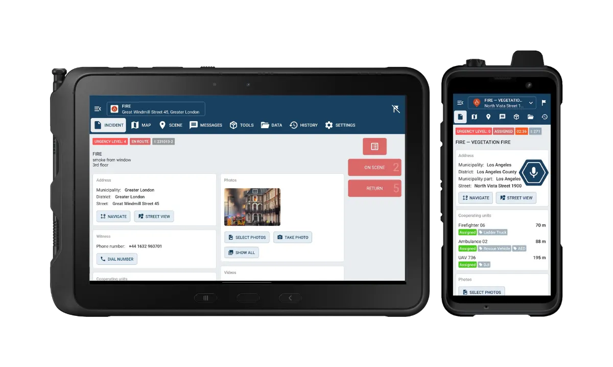
Mobile apps for field teams
Put the full operational picture in the hands of officers, paramedics, and firefighters through GINA Mobile and GINA Tablet. Field teams receive assignments, real-time map updates, and secure messages without losing focus on what is in front of them. Features include live location sharing, tactical whiteboarding, secure communications, and direct integration with the dispatch platform so the field and control room are always in sync.
Analytics and reporting
Every incident, action, and decision is automatically logged and stored in a structured, searchable record. City safety managers get the operational data they need to evaluate response performance, identify coverage gaps, and allocate resources more effectively. Reports are generated directly from live data, eliminating manual reconstruction and ensuring accuracy for audits, compliance, and strategic planning.
An African fire and rescue service speeds up incident response with Smart CAD
Smart CAD improved multi-agency coordination and real-time operational visibility, supporting faster decisions and more controlled response.