
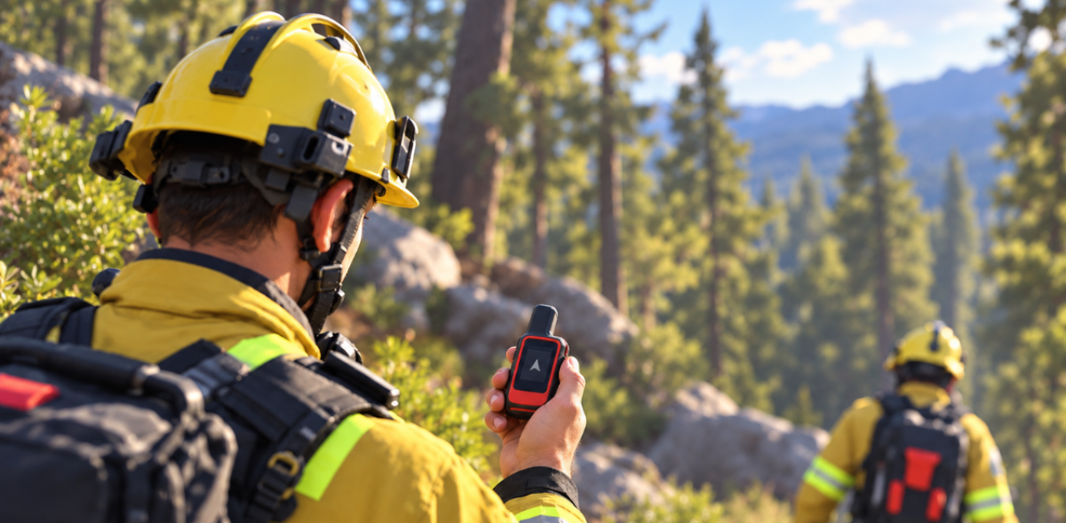
GPS trackers are usually thought of as devices for finding a car or a lost bag. In emergency response, they do a more important job. Connected to Smart CAD and Tactical AVL, they turn a list of units into a live picture of where help is.
In this article, we’ll explain how GPS trackers connect to Smart CAD, which tracking sources an agency can combine, what changes on a real call and why it matters. If you want the difference between GPS and AVL explained first, read our guide to automatic vehicle location.
Table of Contents
The Problem GPS Tracking Solves in Dispatch
Without live positions, a dispatcher works from assumptions. The ambulance is shown at its base because that is where it started the shift. The patrol car is “somewhere in sector four.” The fire engine that just cleared a call is probably on its way back. To be sure, the dispatcher has to call each unit and wait for an answer, while the caller is still on the line.
Units rarely sit at their stations. They are returning from hospitals, on patrol or finishing another job. Sending the unit whose station is closest often means sending the wrong one, and every radio check-in adds seconds and traffic to a channel that should be free for urgent messages.
How GPS Trackers Connect to Smart CAD
A GPS tracker is a small device that calculates its position from satellites and sends it over a cellular, radio or satellite network to a server. On its own, that position is just a coordinate. Connected to Smart CAD, it becomes part of dispatch:
- The tracker reports its position. A tracker installed in a vehicle, or carried by a person, sends location data continuously.
- Smart CAD links the tracker to a unit. Each device is tied to a specific vehicle, crew or asset, so the map shows “Ambulance 12,” not an anonymous dot.
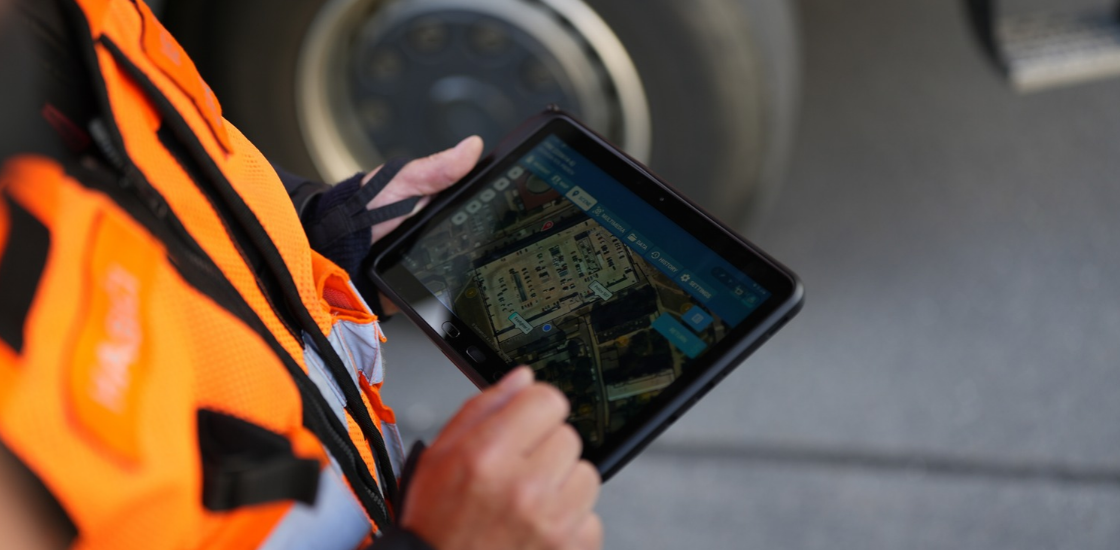
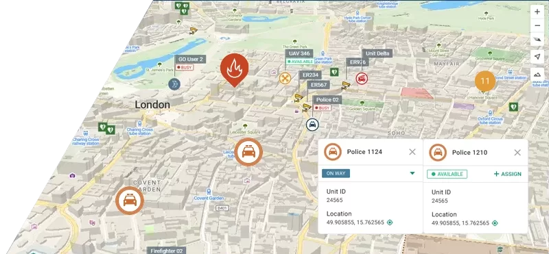
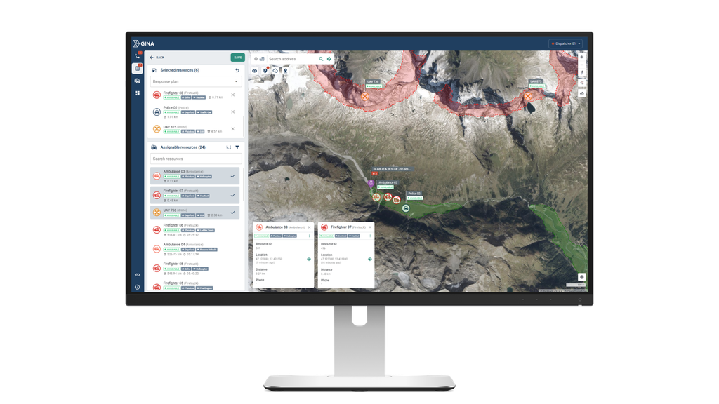
- The unit appears on the map with its status. Dispatchers see position and availability together, next to active incidents and points of interest.
- Smart CAD suggests units. When an incident is created, machine-learning algorithms suggest the units for the quickest response, based on where they really are.
- The route is followed live. The dispatcher and the incident commander watch the unit approach and can redirect it if something changes.
- Movements are recorded. Through Tactical AVL, movement history is kept for review and geofences trigger alerts when a unit enters or leaves a defined area.
GPS Trackers and Other Tracking Sources
GPS trackers are one of three ways Smart CAD and Tactical AVL can locate units. Most agencies combine them, and all positions appear on the same map.
| Source | Best suited for | What to keep in mind |
| GPS trackers | Vehicles, trailers, equipment and assets that should always be visible, regardless of who is on shift | Needs to be installed or carried, and powered |
| Phones and tablets with GINA Apps | Crews, commanders, volunteers and responders on foot | Tracks the person or device, so it moves with the user |
| Mobile radios | Teams that already rely on radios with location capability | Depends on the radio network and its location features |
Tactical AVL can track as many as 100,000 units and devices at the same time, so the same map works for a single city fleet or a national operation. It also brings in sensor data, such as H2S gas sensors on oil and gas sites or IoT sensors for CO2, which lets a position come with context about the conditions around it.
What Changes on a Real Call
At 16:20, a call reports a man who has collapsed in a shopping center. The closest ambulance station is two kilometers away, and the dispatch board shows one ambulance available there. Without live tracking, that is the ambulance the dispatcher sends.
With GPS trackers connected to Smart CAD, the map shows something different. The ambulance at the station is available, but a second one has just left a hospital six hundred meters from the shopping center and is back in service. Smart CAD suggests it first. The dispatcher assigns it, watches it turn toward the scene and tells the caller help is about two minutes away. The ambulance at the station stays free for the next call.
The same logic works on an industrial site. A security patrol at a refinery carries a tracker. When it enters a restricted zone, a geofence alert appears in the control room, and the operator can see exactly where the patrol is if an alarm goes off nearby.
Why GPS Trackers Matter in Emergency Response
| Radio check-ins | GPS trackers with Smart CAD | |
| Knowing where units are | Last reported position, often at the station | Live position on the dispatch map |
| Choosing a unit | Closest station | Units suggested for the quickest response from their real positions |
| Following the response | Radio calls to ask for progress | Unit visible all the way to the scene |
| Radio traffic | A check-in for every question | Location travels as data |
| Safety of crews | Position known only if the crew reports it | Position visible even if the crew cannot talk |
| Review after the incident | Radio logs and notes | Movement history and geofence alerts |
In practice, this gives agencies:
- Faster responses, because the closest available unit is sent, not the closest station.
- Better use of the fleet, because units in service away from base are no longer invisible.
- Crew safety, because dispatch can see where a team is when it cannot answer the radio.
- Quieter radio channels, because location no longer needs to be reported by voice.
- Accountability, because movement history shows how a response unfolded.
GPS is accurate, but not perfect. GPS-enabled smartphones are typically accurate to within 4.9 meters under open sky, and accuracy gets worse near buildings, bridges and trees (GPS.gov). That is one reason to combine vehicle trackers with other sources and to show the position together with status and incident context, not on its own.
What to Check Before Connecting GPS Trackers to Dispatch
- Which trackers do you already have? Many fleets already carry trackers for fuel or maintenance reporting. Ask whether those devices can feed dispatch before buying new ones.
- Is every tracker tied to a unit? A position is only useful if the dispatcher knows which vehicle or crew it belongs to.
- Who needs to be tracked? Vehicles, equipment and people on foot may need different devices.
- Who can see positions? Location data is sensitive. Agree which roles see which units and how long history is kept.
Part of a Connected Platform
GPS trackers are one of several integrations that feed the same incident picture in Smart CAD. Crews carrying phones and tablets with GINA Apps appear on the same map, and video from cameras and drones can be opened next to the units responding. Together, they show dispatchers not just where an incident is, but who is closest and what they will find when they arrive.
Want to see your own fleet on the Smart CAD map? Request a demo and talk to our team.