

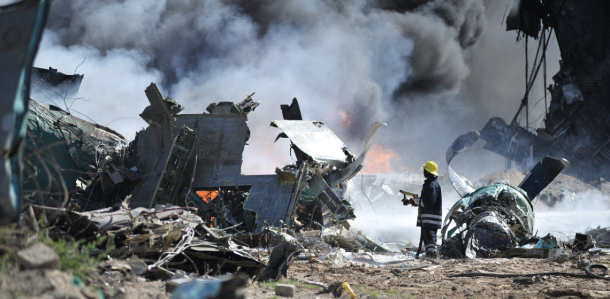
Weather Alert systems have evolved from simple sirens and broadcast messages into sophisticated, real-time networks capable of detecting and responding to environmental threats faster than ever before. In today’s world of increasingly unpredictable weather patterns – from flash floods to hurricanes, wildfires, and snowstorms – the importance of early warning systems cannot be overstated.
Modern weather alert technologies are not just about providing updates; they are about delivering actionable intelligence that empowers emergency services and the public to make informed, timely decisions. As climate change drives more extreme weather events, our capacity to anticipate and respond becomes a matter of life and death.
In this post, we’ll explore the evolution of weather alert systems, how they work, and why integrating technologies like Smart CAD (Computer-Aided Dispatch) is revolutionizing how emergency services handle weather-related crises.
Table of Contents
The Evolution of Weather Alerts
Historically, weather alerts began with basic tools – barometers, wind vanes, and handwritten forecasts based on observation. The development of the telegraph and, later, the radio and television helped spread warnings more widely, but they were still often reactive.
Fast forward to the 21st century, and we now have a network of meteorological satellites, ground-based radar, and real-time data modeling that can detect weather anomalies long before they hit. This gives emergency services critical lead time to prepare, respond, and evacuate populations if necessary.
Modern weather alert systems leverage:
- Remote sensing (e.g., satellite imagery, radar)
- IoT-enabled sensors on the ground
- AI-based prediction models
- Geospatial data for region-specific warnings
These tools form the foundation of national and international early warning systems, which feed weather data into centralized platforms that can trigger alerts to agencies, media outlets, and individuals via SMS, apps, or public broadcasts. Just as important, these systems are increasingly designed to minimize false alarms and deliver clear, plain‑language guidance so the public knows how to act, not just that a risk exists.
The Role of Early Warning Systems
An early warning system (EWS) does more than just issue an alert. It operates through a four-stage framework:
- Risk Knowledge – Understanding and mapping threats.
- Monitoring & Warning – Continuous observation of risk indicators.
- Dissemination & Communication – Timely delivery of understandable warnings.
- Response Capability – Ability of institutions and the public to act.
A robust EWS helps prevent disasters from becoming catastrophes. For instance, early warnings of severe storms allow time for precautionary measures; flood alerts can lead to the fortification of critical infrastructure; wildfire warnings can prevent people from entering high-risk zones. Crucially, EWS performance depends on trust, reach, and redundancy: alerts must be credible, accessible to all communities (including vulnerable groups), and backed by backup channels if one pathway fails.
Smart CAD: Bridging Alerts and Action
While weather alerts provide critical information, the real challenge lies in coordinating an effective response. This is where Smart CAD (Computer-Aided Dispatch) comes in.
What is Smart CAD?
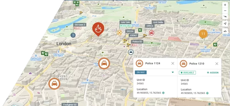
Smart CAD is an intelligent dispatch platform used by emergency services – police, fire departments, EMS, and disaster response units – to manage incidents in real time. It brings together key operational data such as unit locations, incident reports, and geographic context into one unified interface. By streamlining communication and improving visibility across teams, Smart CAD supports faster coordination and more effective decision-making during emergencies.
How Smart CAD Enhances Weather Alert Response
When a weather alert is issued – say, a flash flood warning – Smart CAD system can:
- Automatically map affected zones, including high-risk roads or infrastructure.
- Re-route units in real time to avoid dangerous areas.
- Trigger response protocols, such as activating shelters or deploying support resources.
- Deliver up-to-date information to field responders via mobile devices.
- Help prioritize resource allocation based on location and severity.
The system can support emergency operations during severe weather by helping responders stay organized, informed, and connected. By providing a clear operational overview and improving coordination across teams, it contributes to a more efficient and timely response when conditions are rapidly changing.
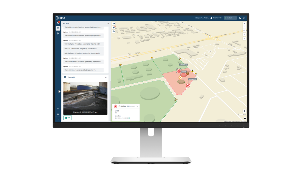
Empowering First Responders
Smart CAD doesn’t just help dispatchers – it empowers on-the-ground responders with better situational awareness. Through a unified interface, field units can:
- Access location-based information to support situational awareness
- Communicate securely with command centers
- Log incidents in real time for better resource tracking
It helps keep teams aligned during fast‑moving incidents by standardizing workflows, checklists, and handoffs. Clear status tracking and role‑based views reduce friction between dispatch, field units, and command, so everyone works from the same operational picture.
Structured incident timelines, activity logs, and outcome notes make it easier to conduct after‑action reviews. Consistent records support training, policy refinement, and compliance – turning each response into lessons that strengthen the next one.
Turning Warnings into Action
Weather alerts save lives – but only when they’re acted upon. Technology like Smart CAD ensures those alerts are transformed into meaningful, timely action that protects communities and resources. As extreme weather events become more common, investing in early warning systems and smart emergency tech isn’t a luxury – it’s a necessity.
By linking meteorological science with real-time communication and coordinated emergency response, we’re building a world where alerts don’t just inform – they empower.