

Next Generation Police CAD
Accelerate emergency response with real-time insights, mobile access, and automation delivered by user-friendly CAD software tailored to law enforcement agencies.
Trusted by first responders


Why GINA Software?


Designed for Efficiency
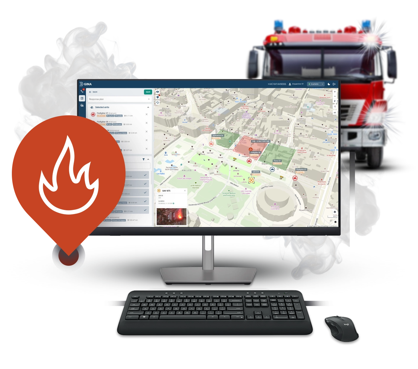
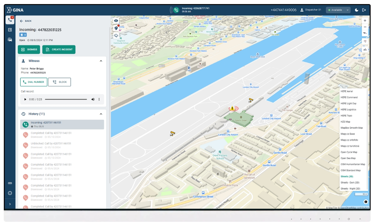
Faster, smarter dispatch
Streamline call-taking and quickly assign the most suitable on-duty officers. With GINA, police dispatchers automate routine tasks and reduce response times.
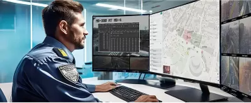
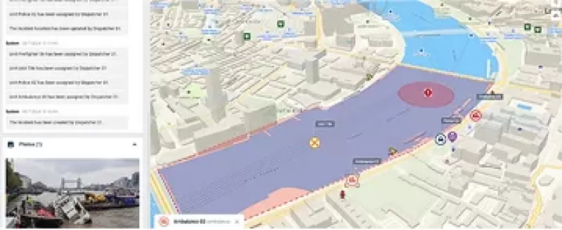
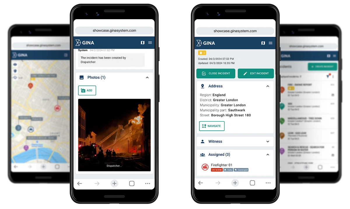
Real-time situational awareness
Ensure both officers and dispatchers have the most accurate view of the scene. Make informed decisions with live maps, incident information sharing, unit locations, updates, pictures, etc.

Seamless communication
Share and access information anytime, anywhere to ensure effective coordination. GINA integrates with major radio manufacturers, databases, CCTV, satellite and GSM trackers, sensors, IoT, wearables, bodyworn cameras, and more.
See Why Your Peers choose police CAD system by GINA

Sygic
Partnering with solution providers, such as GINA, who create products that truly answer the needs of people and communities has been pretty amazing. Seeing how technology makes a difference in the real world is why we do what we do. And the results speak for themselves.

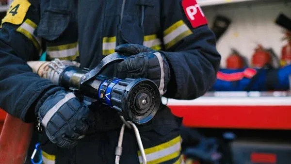
Fire Rescue Service of the Czech Republic
GINA significantly improves the efficiency of both routine and special operations, reduces arrival time, provides real-time information support, and increases the level of cooperation among all responding units. Thanks to technology we can react flexibly to altering situations in the field.
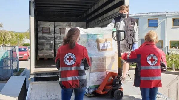
Czech Red Cross
Many of our members are volunteers who go out from their homes to the scene. At a time like this, it’s great to have an app that lets you see on a map how people are converging on the scene. You can then coordinate much better, for example, by talking to drivers.


GM Risk Group
We have been working with GINA for a few years now and have found the software solutions to be a functional tool for our teams on the ground, plus a value add to our clients through our increased service capabilities. GINA provides our team and clients with high-level situational awareness by allowing us to tailor how we integrate, manage and share intelligence that is relevant to our teams and task objectives.

Alpha 6 Canada
I was looking for a solution that would handle tracking as well as incident command and I found that in GINA. We can send messages, set up geofences, track our assets and it has good app that goes with it for the smartphone for our clients. GINA provides a lot of things for us. It brings a lot of things together – the tracking, the messaging and then the reporting.
G2S Group
GINA has been our partner for the past two years in creating and implementing new and tailored systems for our Security company. We are also a business partner for them in the Horn of Africa region as both Facilitator and Reseller for GINA Software in Public Safety, Defense and Security, and Oil and Gas. They are reliable, thorough, smart, available, excellent communicators, and friendly! As a Partner of GINA’s solutions, we’ve obtained a broad positive reception, and allows us to meet the clients’ requirements successfully.
All-in-one intelligent CAD Software for Police
Smart CAD is an advanced computer-aided dispatch (CAD) software that empowers police agencies with fully digital workflows.
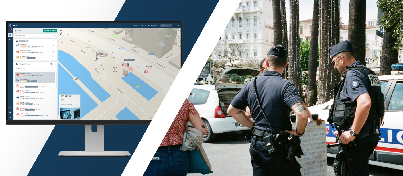
Streamline call handling
Simplify emergency call management and seamlessly assign officers using a modern, web-based interface. Smart CAD optimizes dispatch workflows, automates routine tasks, and ensures faster, more accurate responses to incidents.
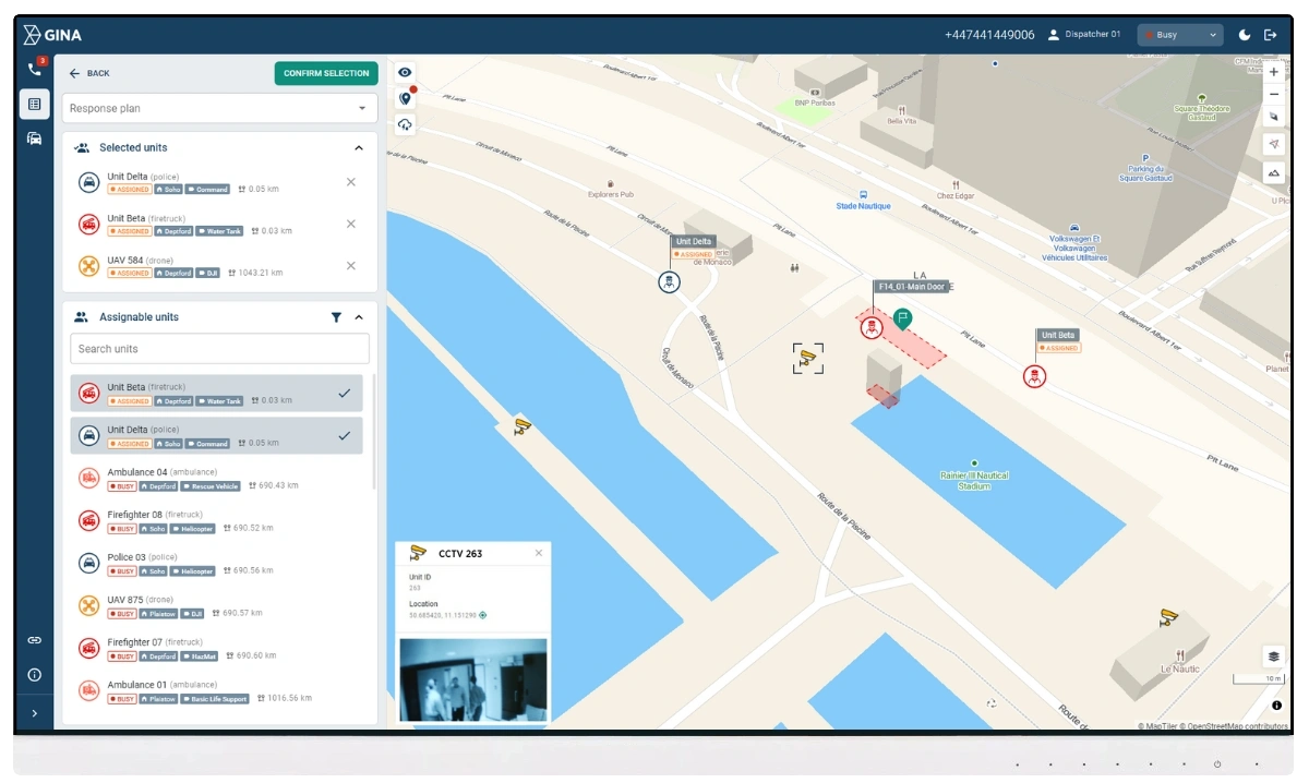
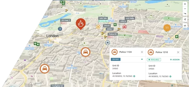
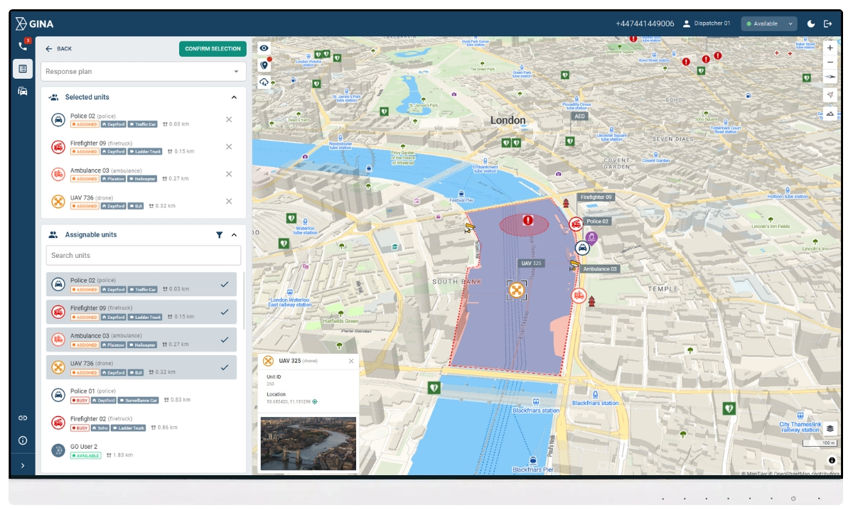
Rapid and Intelligent Dispatch
Deploy units quickly based on real-time availability, proximity, and operational needs. Leverage live, map-centric tracking of unit locations, statuses, and positions for enhanced situational awareness. Integrate CCTV feeds for instant visual insights and better-informed decision-making.
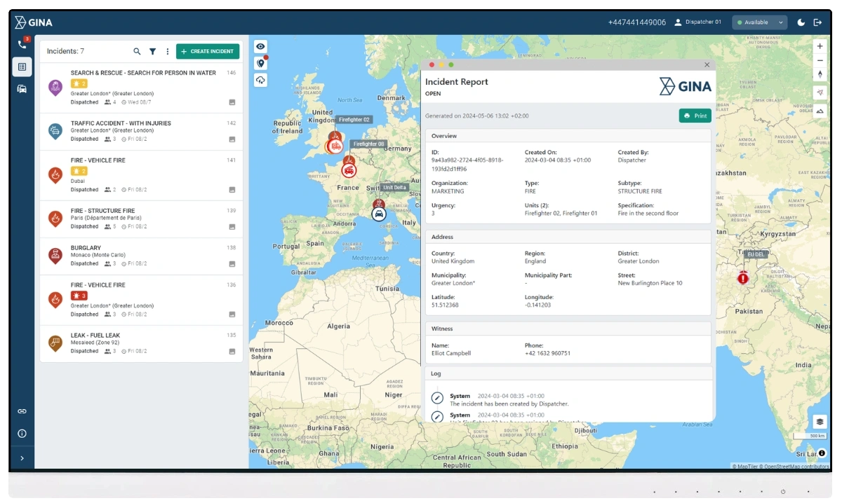
Comprehensive record management system
Smart CAD automatically logs all incident details, including communications, actions, and timelines, to support investigations, records management, and compliance. Reduce errors with automated data pulls and centralized storage, all within one unified platform.
Seamless system integration
Integrate GINA CAD with third-party tools and technologies effortlessly. Smart CAD supports major radio systems, CCTV, GPS trackers, IoT devices, wearables, body-worn cameras, and more – ensuring a connected and informed law enforcement response.
Mobile-ready
Equip officers with mobile apps designed to improve communication, coordination, and situational awareness. Features include real-time mapping, location tracking, live data transfer, tactical whiteboarding, secure messaging, and live video streaming, ensuring officers remain connected and informed on the scene.
Real-time location tracking
Enhance field coordination with precise, real-time unit tracking and visual mapping. Smart CAD supports various monitoring methods, including radio systems, GPS trackers, and native mobile apps – ensuring you always know where your units are and how they’re positioned.
An African fire and rescue service speeds up incident response with Smart CAD
Safeguarding a community of over 1 million people, the fire and rescue service has addressed fundamental emergency management challenges and enhanced response efficiency with Smart CAD.