
Harbor Emergency Software
Smart CAD is software for harbor incident management, security and emergency response. It connects geofencing, live video, vessel tracking and team communication in one view, so you reduce downtime, protect infrastructure and respond faster to every incident.
Trusted by first responders


Why GINA Software?


Transform your harbor operations with Smart CAD
Security enhancement
Protect restricted zones, critical infrastructure and vessel movements in one unified view. Automated geofencing, instant alerts and integrated video monitoring reduce blind spots and unauthorized access, so your teams react fast instead of discovering problems after the fact.

Safer operations
Operators, field staff and security teams share the same operational picture. From live video feeds and unit locations to clear status updates, everyone knows what is happening and what to do next. This reduces errors, miscommunication and risk during routine operations and emergencies.

Reduced downtime
Faster detection, clearer coordination and smarter decisions mean incidents are resolved sooner and disruptions are shorter. Smart CAD helps you minimize closures, delays and secondary damages, which protects revenue and reduces the pressure for costly infrastructure overhauls driven by security gaps.
See why agencies like yours choose Smart CAD

Sygic
Partnering with solution providers, such as GINA, who create products that truly answer the needs of people and communities has been pretty amazing. Seeing how technology makes a difference in the real world is why we do what we do. And the results speak for themselves.

Fire Rescue Service of the Czech Republic
GINA significantly improves the efficiency of both routine and special operations, reduces arrival time, provides real-time information support, and increases the level of cooperation among all responding units. Thanks to technology we can react flexibly to altering situations in the field.
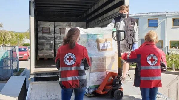
Czech Red Cross
Many of our members are volunteers who go out from their homes to the scene. At a time like this, it’s great to have an app that lets you see on a map how people are converging on the scene. You can then coordinate much better, for example, by talking to drivers.

GM Risk Group
We have been working with GINA for a few years now and have found the software solutions to be a functional tool for our teams on the ground, plus a value add to our clients through our increased service capabilities. GINA provides our team and clients with high-level situational awareness by allowing us to tailor how we integrate, manage and share intelligence that is relevant to our teams and task objectives.

Alpha 6 Canada
I was looking for a solution that would handle tracking as well as incident command and I found that in GINA. We can send messages, set up geofences, track our assets and it has good app that goes with it for the smartphone for our clients. GINA provides a lot of things for us. It brings a lot of things together – the tracking, the messaging and then the reporting.
G2S Group
GINA has been our partner for the past two years in creating and implementing new and tailored systems for our Security company. We are also a business partner for them in the Horn of Africa region as both Facilitator and Reseller for GINA Software in Public Safety, Defense and Security, and Oil and Gas. They are reliable, thorough, smart, available, excellent communicators, and friendly! As a Partner of GINA’s solutions, we’ve obtained a broad positive reception, and allows us to meet the clients’ requirements successfully.
Geofencing and access control
When a vessel, vehicle, asset or staff member enters or leaves an area without authorization, the system triggers instant notifications and audible warnings. This helps prevent breaches, reduces theft and supports compliance with ISPS and internal security policies.
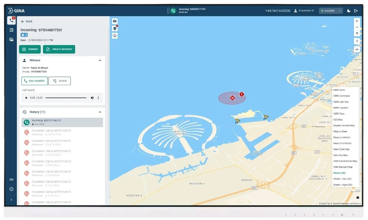
Real time situational awareness with live video
Smart CAD integrates live feeds from CCTV, body worn cameras and drones into a single operational view. During a security alert or emergency, operators can see the scene immediately, verify the threat and guide responders with visual information instead of guesswork.
Unified communication for harbor teams
Smart CAD gives harbors a unified platform for security, incident management and emergency response. With real time locations, video feeds and clear communication, teams detect issues earlier, react faster and keep both operations and perimeter security under control.
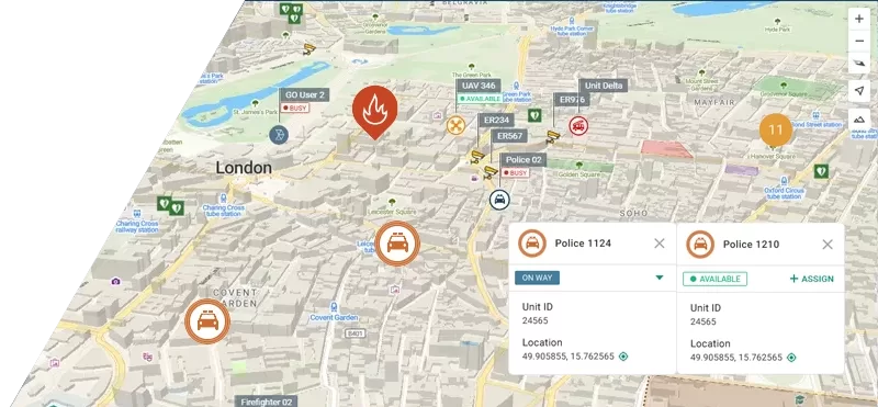
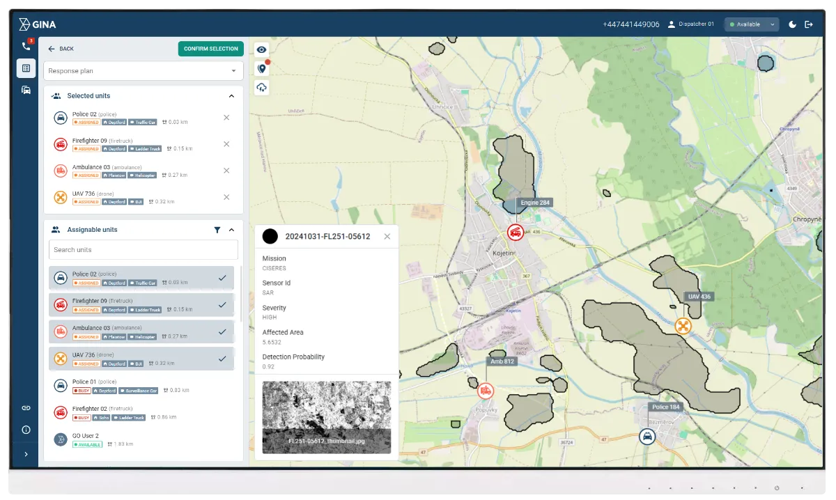
Location tracking
Smart CAD shows the live location of staff, vehicles, vessels and other key resources on a single map. Operators can assign the closest suitable unit, coordinate movements around the harbor and avoid conflicts between operations and security activities.
Safer navigation with real time data
GINA Apps support safer navigation by providing real time weather updates and access to maritime charts to staff in the field. AIS integration allows continuous vessel tracking, so you always know which ships are approaching, docked or departing and how they interact with your operational zones.
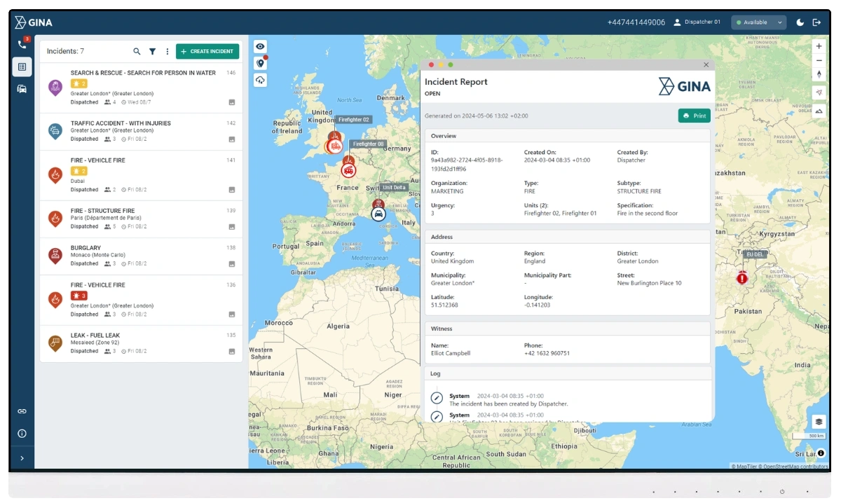
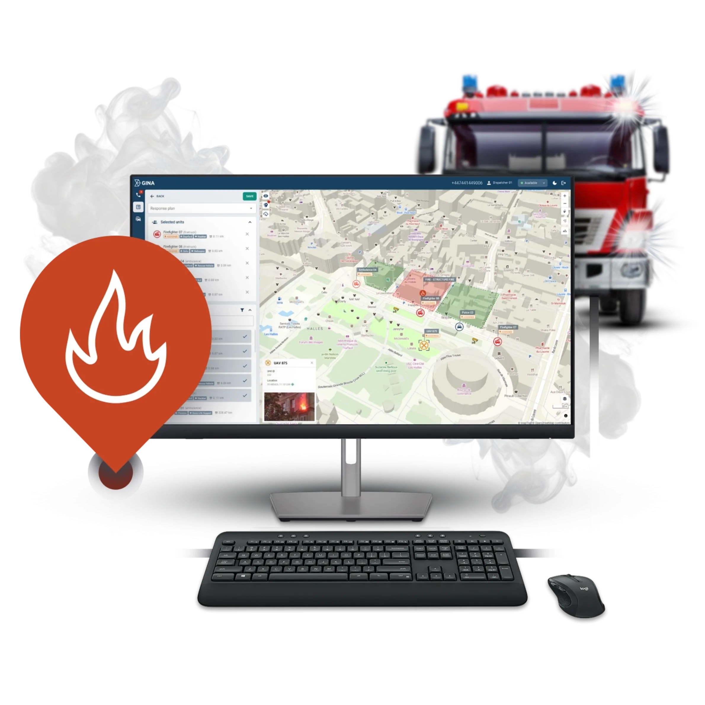
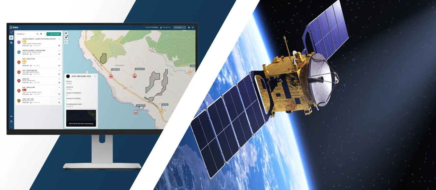
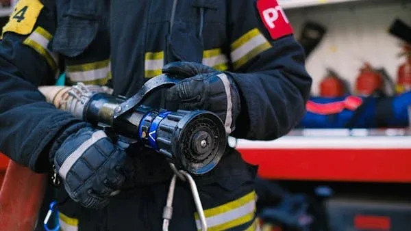
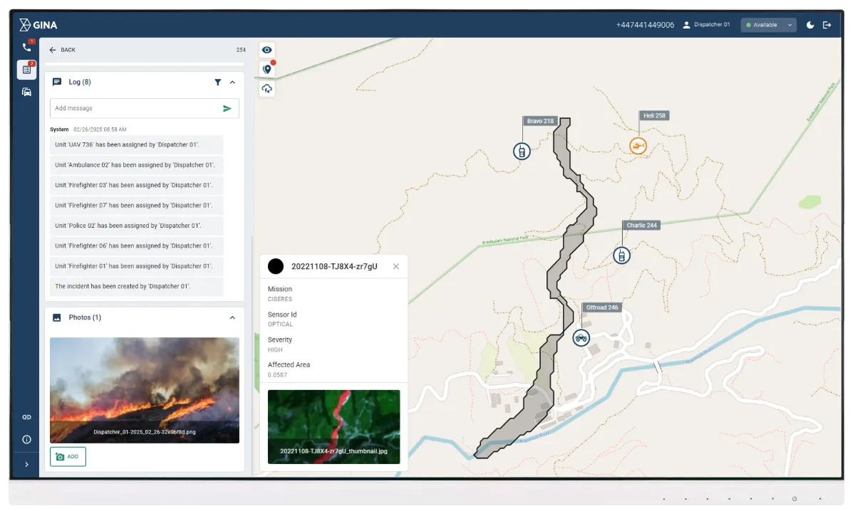
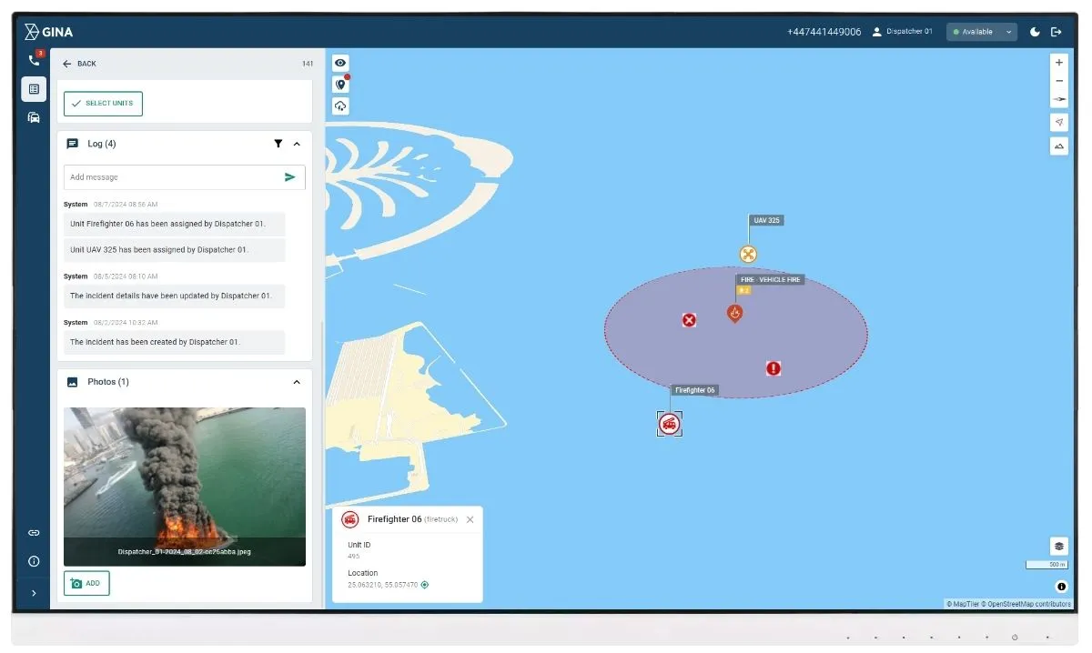
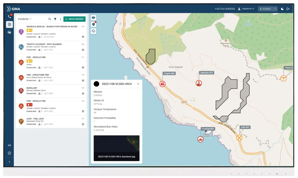
Efficient incident management
From suspicious activity and unauthorized access to fires, medical emergencies or environmental incidents, Smart CAD guides operators through the full incident lifecycle. Incidents are created, classified and prioritized in a structured way. Tasks, units and resources are assigned and tracked. Communication, locations and video are all linked to the same event. After resolution, you have a complete digital record for reporting, investigation and continuous improvement.
Lower operational and security costs
By reducing unauthorized access, improving coordination and shortening disruptions, Smart CAD helps harbors avoid costly delays, claims and secondary damages. Better visibility and data-driven planning limit the need for reactive infrastructure investment purely to compensate for process gaps.
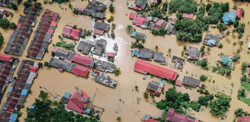
Nationwide public safety organization enhances emergency response with GINA
GINA has deployed Smart CAD in over 1,000 local centers and 60 control rooms used by external agencies in the ASEAN region, empowering call takers and dispatchers to manage incidents more efficiently.