
Emergency Response Software for Mining Disasters
Manage people, vehicles, and critical assets across mining sites in real time. Smart CAD supports safety, coordination, and incident response in complex, high-risk environments where visibility and timing matter.
Trusted by first responders worldwide


Why GINA Software?


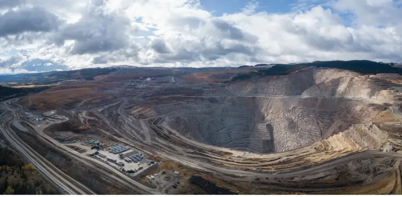
How Smart CAD supports safer mining operations
Clear operational picture
Mining sites are complex environments with constant movement and changing conditions. A shared view of the operation helps teams understand what is happening across pits, facilities, and access roads at any moment. This reduces uncertainty and supports better decisions throughout the shift.
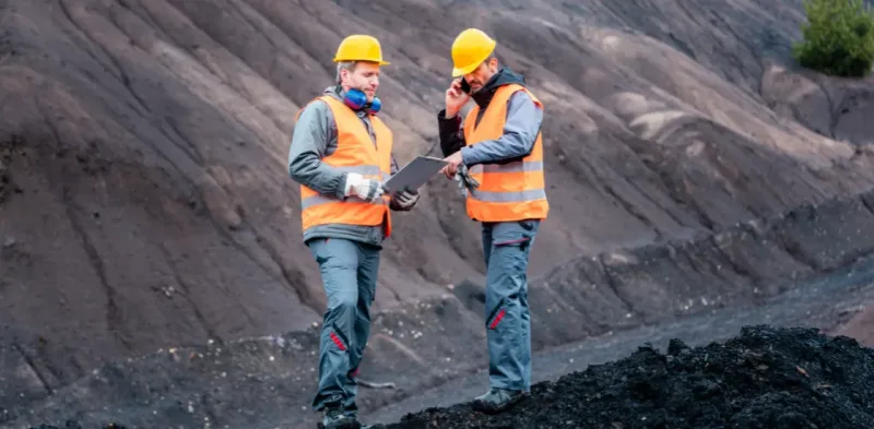
Safer working conditions
Effective oversight supports safer work for employees, contractors, and visitors. Risks are easier to recognize, movements are better controlled, and responses are more predictable. This helps protect people and critical equipment in demanding mining environments.

Reduced operational costs
Unclear situations lead to unnecessary downtime, blocked routes, and idle equipment. Coordinated awareness helps incidents stay contained, keeps traffic flowing, and prevents small disruptions from escalating into costly delays across the site.
See why agencies like yours choose Smart CAD
Sygic
Partnering with solution providers, such as GINA, who create products that truly answer the needs of people and communities has been pretty amazing. Seeing how technology makes a difference in the real world is why we do what we do. And the results speak for themselves.

Fire Rescue Service of the Czech Republic
GINA significantly improves the efficiency of both routine and special operations, reduces arrival time, provides real-time information support, and increases the level of cooperation among all responding units. Thanks to technology we can react flexibly to altering situations in the field.
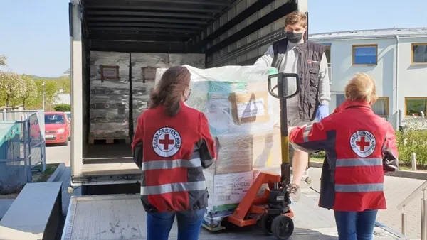
Czech Red Cross
Many of our members are volunteers who go out from their homes to the scene. At a time like this, it’s great to have an app that lets you see on a map how people are converging on the scene. You can then coordinate much better, for example, by talking to drivers.


GM Risk Group
We have been working with GINA for a few years now and have found the software solutions to be a functional tool for our teams on the ground, plus a value add to our clients through our increased service capabilities. GINA provides our team and clients with high-level situational awareness by allowing us to tailor how we integrate, manage and share intelligence that is relevant to our teams and task objectives.

Alpha 6 Canada
I was looking for a solution that would handle tracking as well as incident command and I found that in GINA. We can send messages, set up geofences, track our assets and it has good app that goes with it for the smartphone for our clients. GINA provides a lot of things for us. It brings a lot of things together – the tracking, the messaging and then the reporting.
G2S Group
GINA has been our partner for the past two years in creating and implementing new and tailored systems for our Security company. We are also a business partner for them in the Horn of Africa region as both Facilitator and Reseller for GINA Software in Public Safety, Defense and Security, and Oil and Gas. They are reliable, thorough, smart, available, excellent communicators, and friendly! As a Partner of GINA’s solutions, we’ve obtained a broad positive reception, and allows us to meet the clients’ requirements successfully.
Tools designed for safe and controlled mining operations
Geofencing and access control
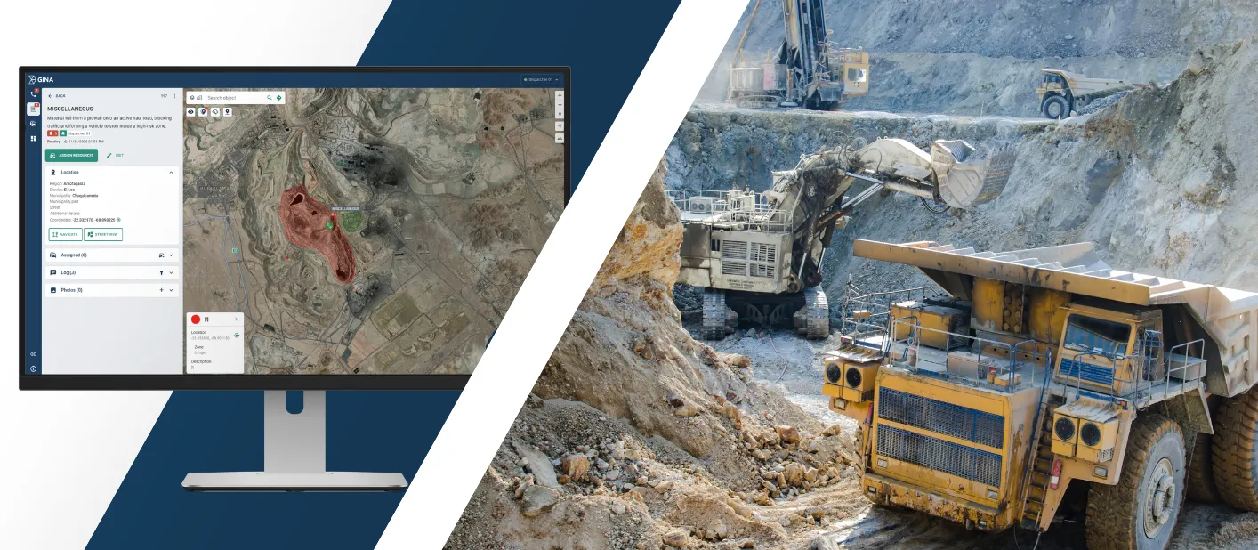
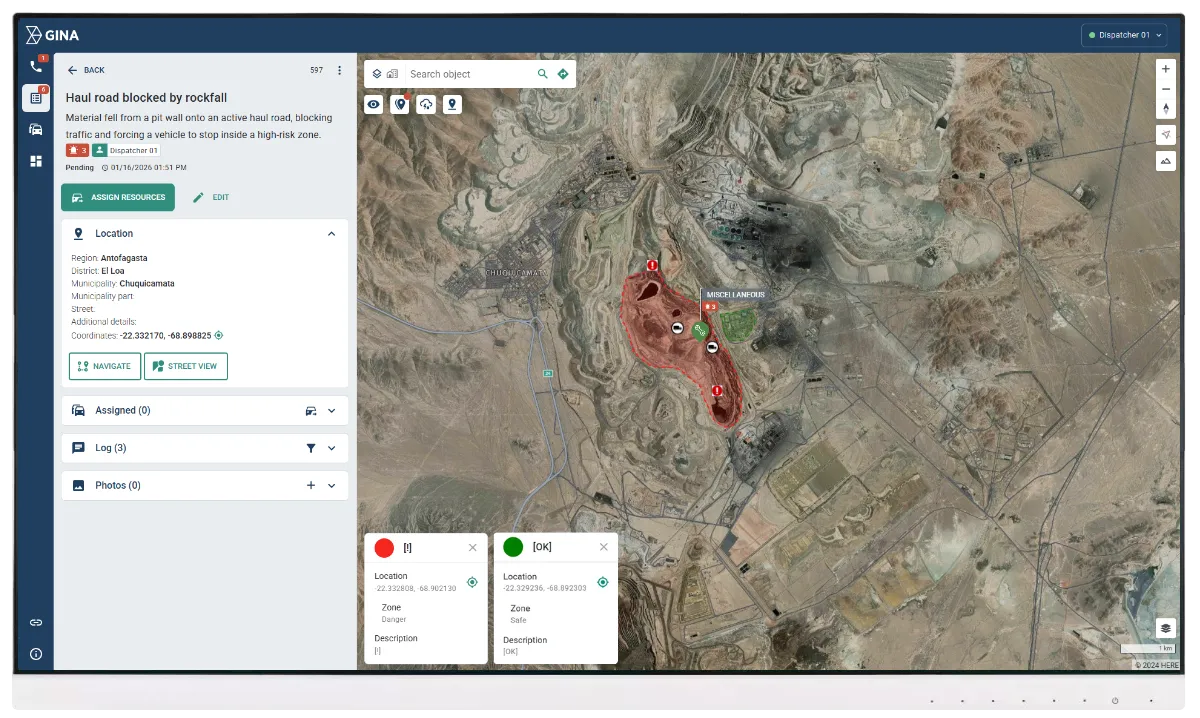
Define operational zones, restricted areas, and high-risk locations across the site based on real mining workflows. Alerts notify teams when vehicles, equipment, or personnel enter or leave designated areas, helping prevent theft, unauthorized access, and unsafe movement. This supports controlled access to pits, haul roads, processing facilities, and other sensitive areas without relying on manual supervision.
Integrated sensors and video management
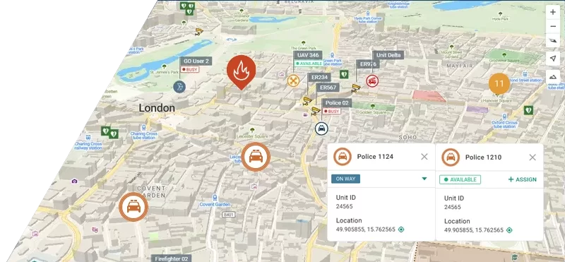
Connect CCTV systems, drones, and environmental sensors into one operational view instead of monitoring them in isolation. Events such as perimeter breaches, abnormal activity, or gas leaks trigger automatic alerts that are immediately linked to a location and incident. This reduces blind spots, shortens detection time, and allows teams to act on verified information rather than raw feeds.
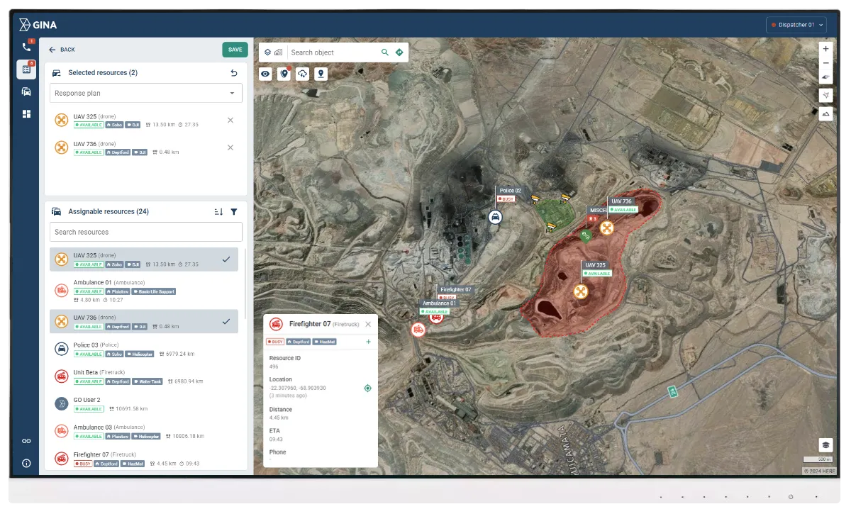
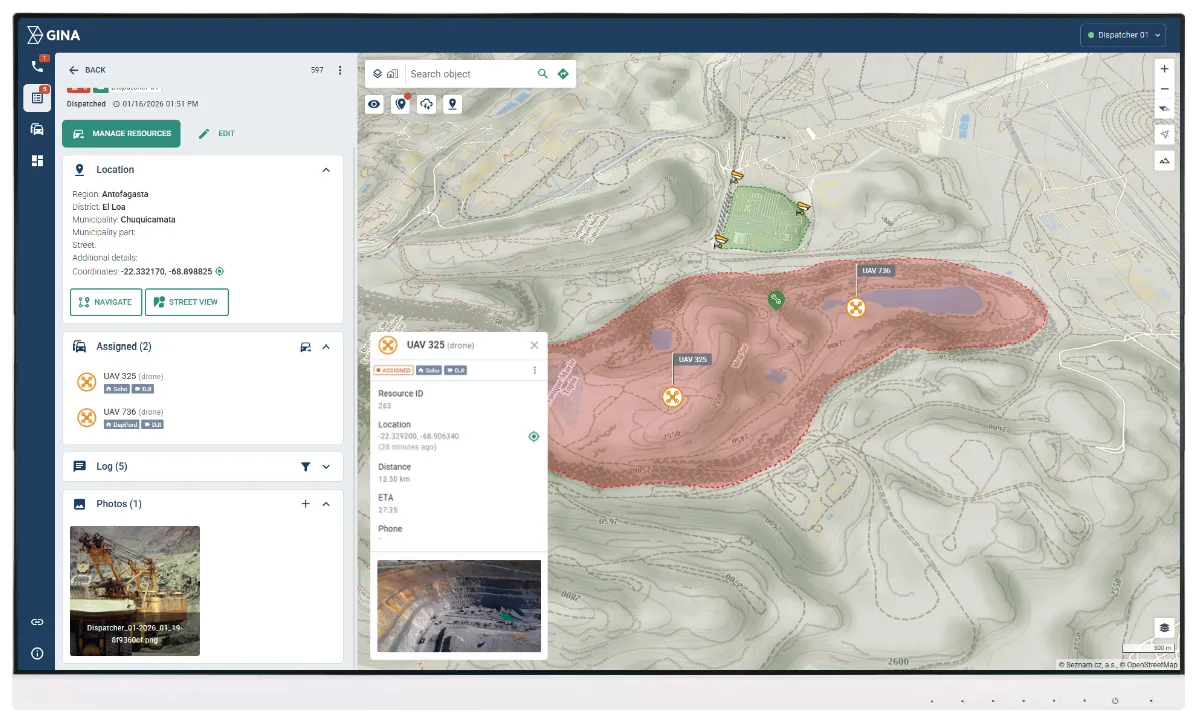
Resource tracking and guided response
Track vehicles, machinery, and mobile assets in real time while linking their position to active incidents. When an alert occurs, the system shows which resources are closest and most suitable, supporting faster and more informed response decisions. This helps reduce unnecessary movements, avoid congestion in hazardous zones, and limit operational disruption.
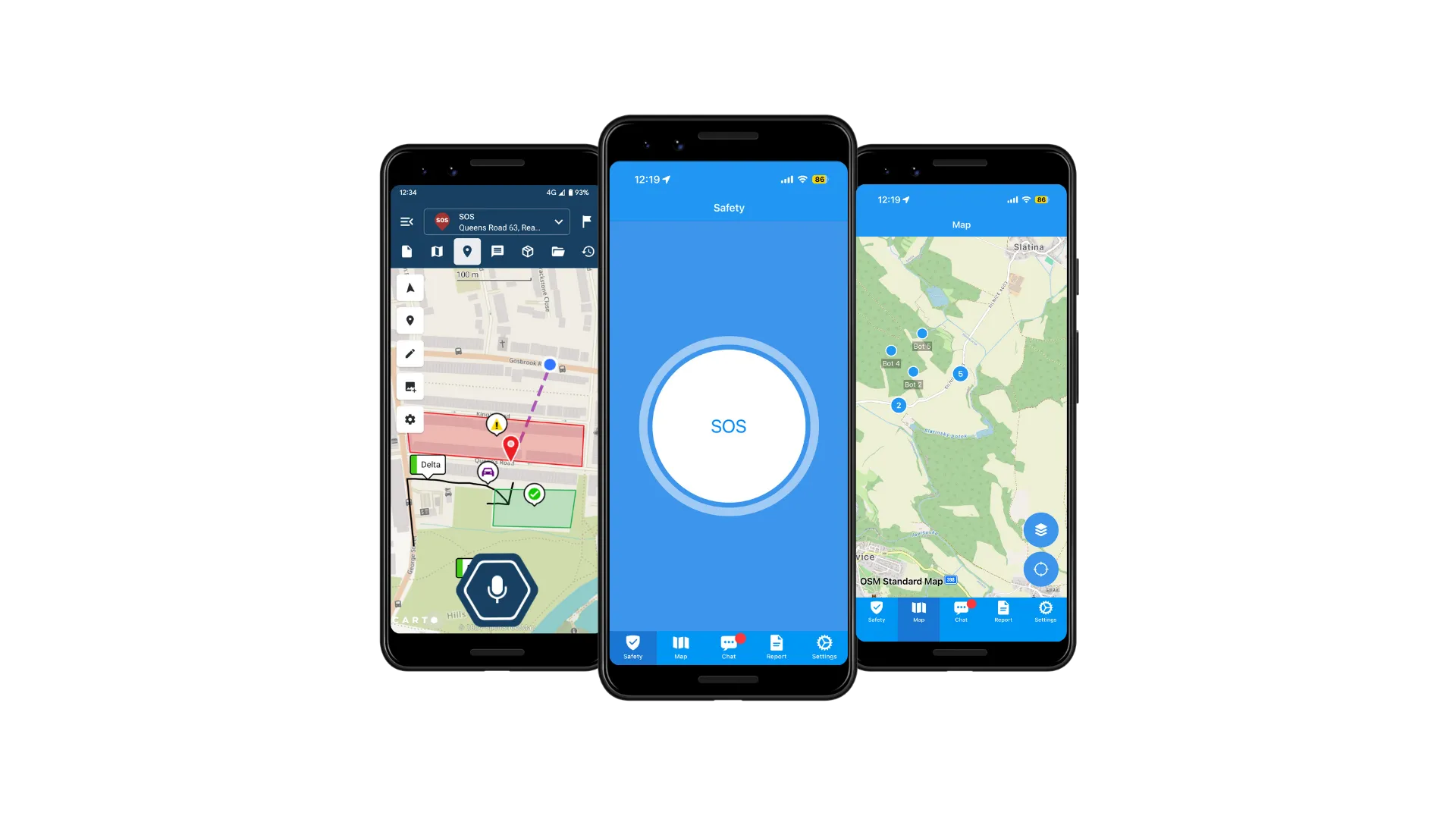
Worker safety and emergency alerts
Support worker safety through mobile and sensor-based emergency signaling. Workers can send an SOS directly from the GINA GO application, while connected devices can indicate dangerous situations such as loss of movement or abnormal conditions. Each alert includes precise location data, allowing control rooms to respond quickly and coordinate assistance without delay
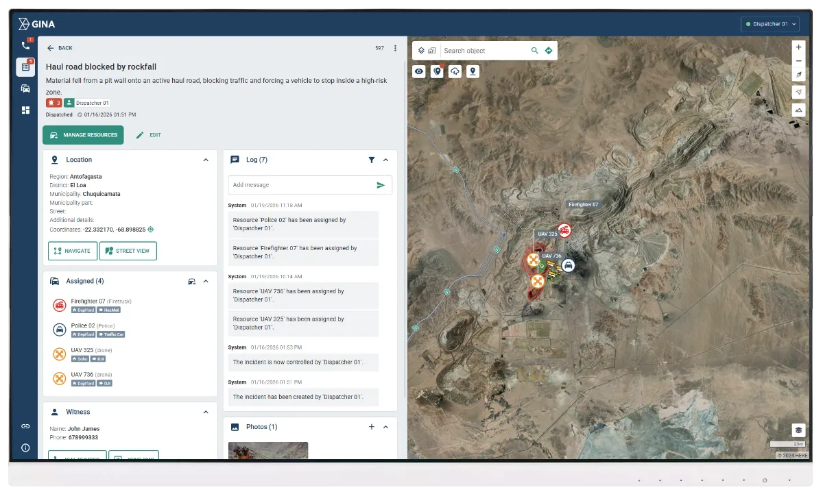
Shared operational log
Radio and digital communication are integrated with task assignment and operational checklists. Dispatchers can issue clear instructions, track progress, and confirm completion while keeping all communication linked to the relevant incident. This reduces misunderstandings, ensures procedures are followed, and keeps teams aligned during routine operations and emergencies.
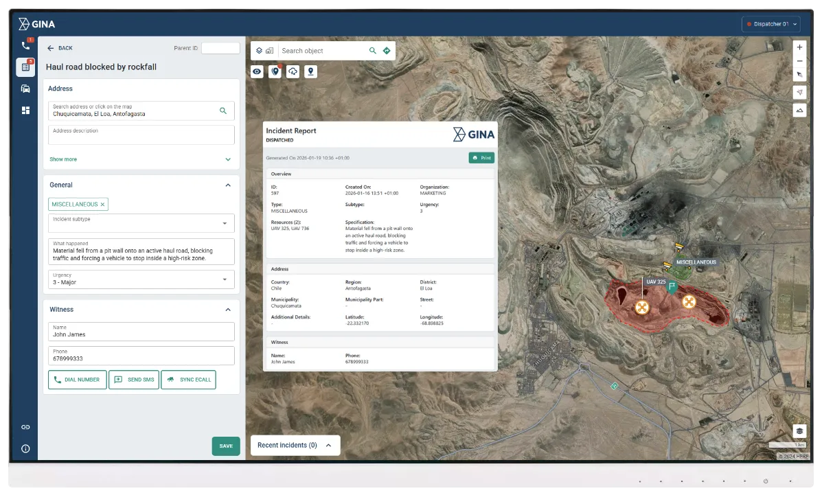
Reporting and compliance
All incidents, actions, and responses are automatically recorded in structured reports. These reports support internal performance reviews, incident investigations, and regulatory or government compliance requirements. Consistent documentation improves accountability and helps identify trends that inform future safety and operational improvements.
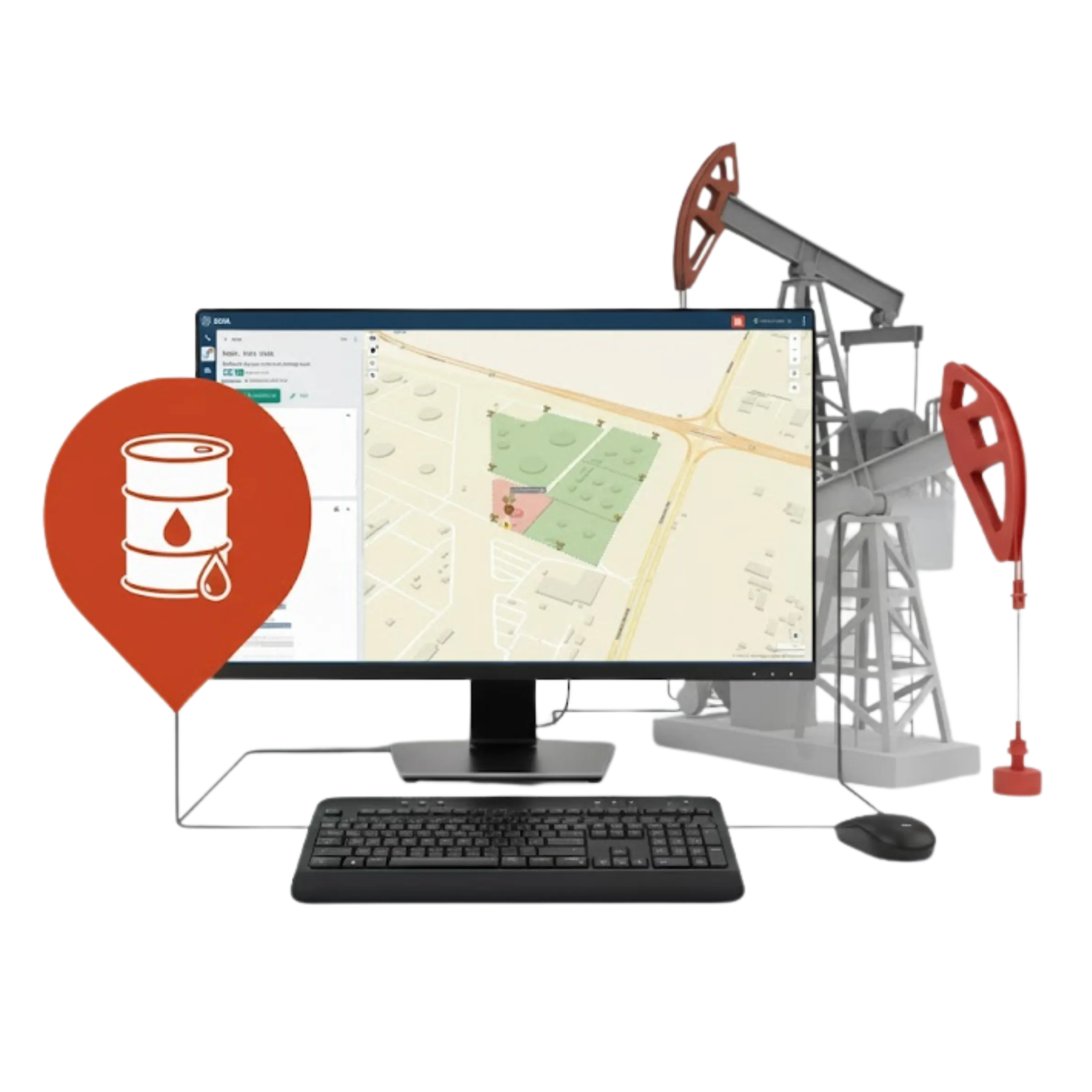
How Smart CAD transformed emergency response in the oil and gas sector
In one large oil and gas processing plant, Smart CAD helped dispatch and response teams react within 20 seconds, a significant improvement over previous response times. By deploying incident management software and integrated mobile apps, operators achieved enhanced coordination and full visibility of critical information during high-risk events.