
Disaster Response Software
Improve disaster response with fast satellite insights from CISERES integrated directly into Smart CAD, supporting clear and confident action during critical events.
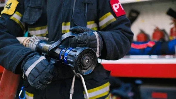
Trusted by first responders worldwide


Why GINA Software?


How CISERES turns complex data into rapid awareness
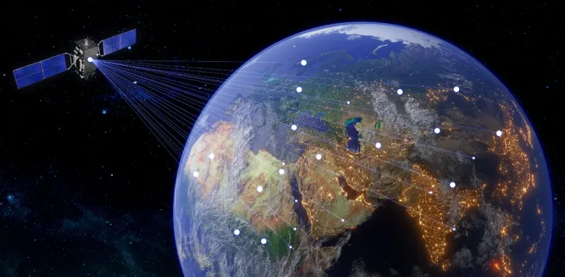
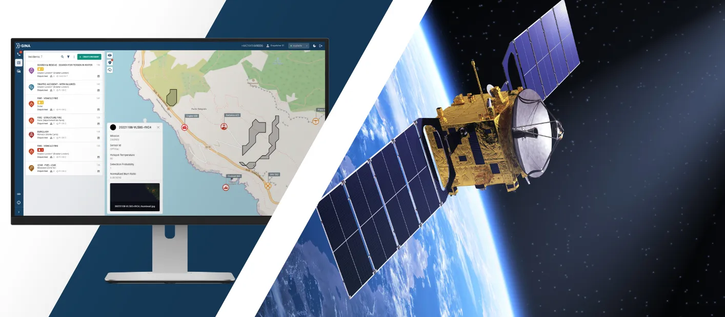
AI powered insights
CISERES uses artificial intelligence onboard satellites to analyse incoming data before it reaches the ground. Instead of transmitting large volumes of raw imagery, the satellite sends the most relevant findings. Emergency agencies receive early indications of fires, floods or land movement within minutes, which helps them react during the critical first phase of a disaster.
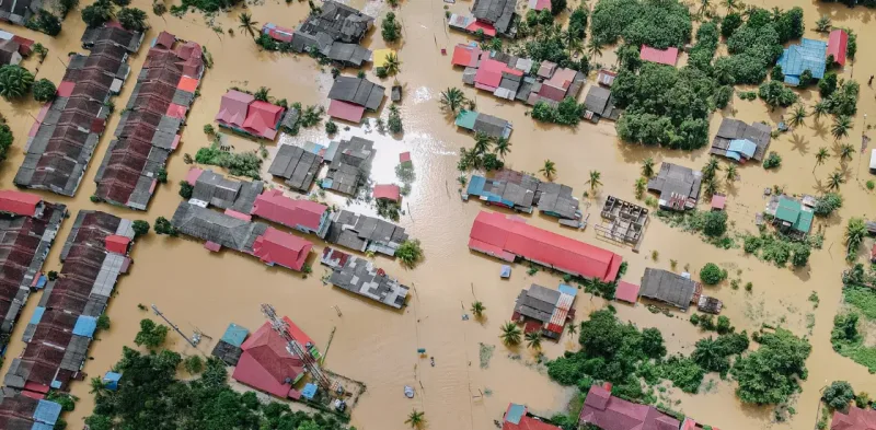
Consistent situational view
Disasters often damage infrastructure or block access to remote areas, and traditional monitoring becomes slow or impossible. CISERES provides a stable information source that continues to operate above the crisis zone. The system maintains visibility regardless of conditions on the ground, giving responders updates throughout the eventn
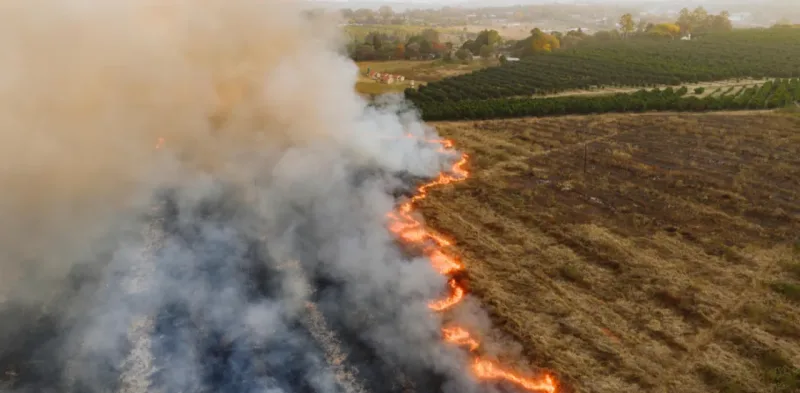
Evolving conditions
CISERES does more than detect single events. It monitors changes over time, showing how hazards expand, shift or intensify. These continuous updates help agencies predict how an incident may develop and support informed planning for evacuation routes, resource allocation and field deployments.
See why agencies like yours choose Smart CAD

Sygic
Partnering with solution providers, such as GINA, who create products that truly answer the needs of people and communities has been pretty amazing. Seeing how technology makes a difference in the real world is why we do what we do. And the results speak for themselves.

Fire Rescue Service of the Czech Republic
GINA significantly improves the efficiency of both routine and special operations, reduces arrival time, provides real-time information support, and increases the level of cooperation among all responding units. Thanks to technology we can react flexibly to altering situations in the field.
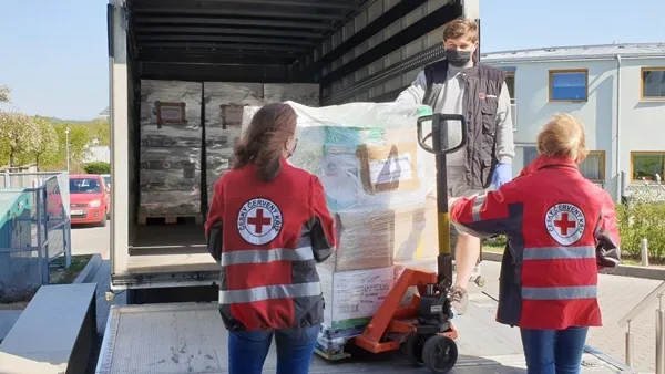
Czech Red Cross
Many of our members are volunteers who go out from their homes to the scene. At a time like this, it’s great to have an app that lets you see on a map how people are converging on the scene. You can then coordinate much better, for example, by talking to drivers.


GM Risk Group
We have been working with GINA for a few years now and have found the software solutions to be a functional tool for our teams on the ground, plus a value add to our clients through our increased service capabilities. GINA provides our team and clients with high-level situational awareness by allowing us to tailor how we integrate, manage and share intelligence that is relevant to our teams and task objectives.

Alpha 6 Canada
I was looking for a solution that would handle tracking as well as incident command and I found that in GINA. We can send messages, set up geofences, track our assets and it has good app that goes with it for the smartphone for our clients. GINA provides a lot of things for us. It brings a lot of things together – the tracking, the messaging and then the reporting.
G2S Group
GINA has been our partner for the past two years in creating and implementing new and tailored systems for our Security company. We are also a business partner for them in the Horn of Africa region as both Facilitator and Reseller for GINA Software in Public Safety, Defense and Security, and Oil and Gas. They are reliable, thorough, smart, available, excellent communicators, and friendly! As a Partner of GINA’s solutions, we’ve obtained a broad positive reception, and allows us to meet the clients’ requirements successfully.
Capabilities that bring satellite data into real operations
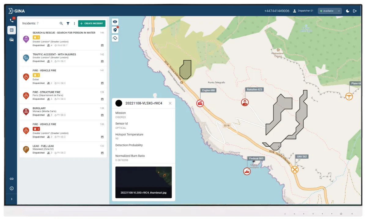
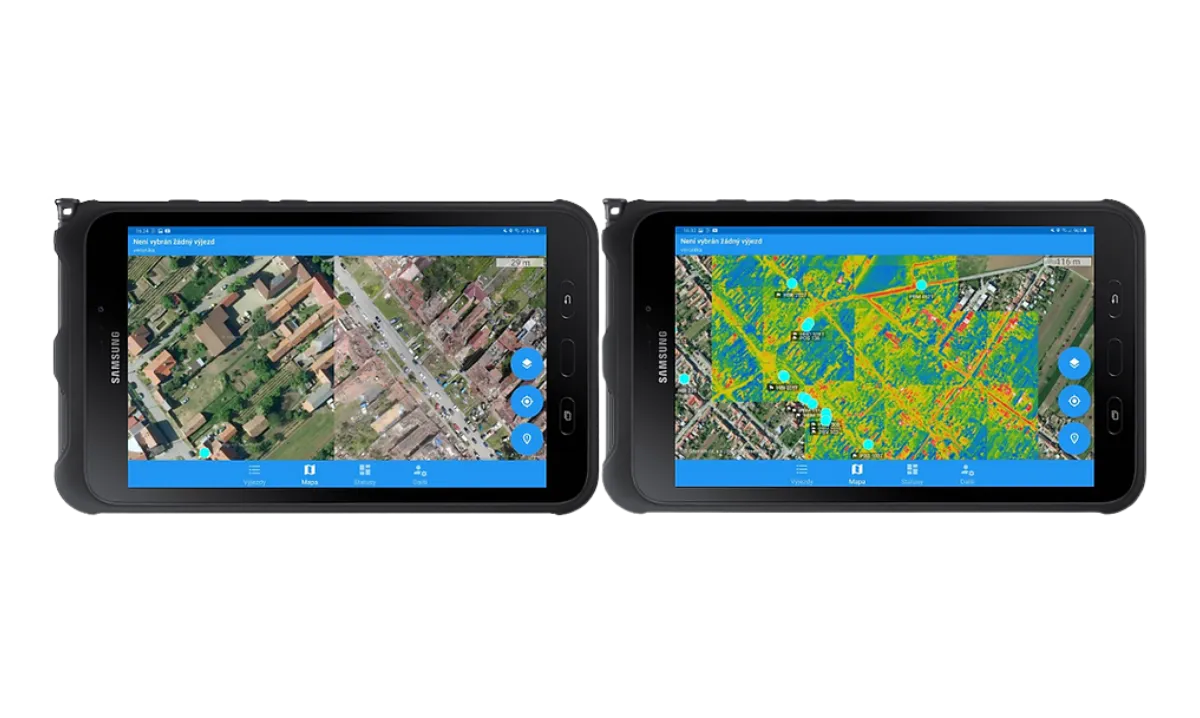
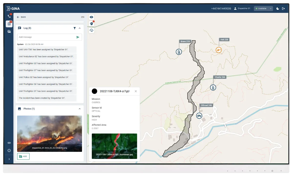
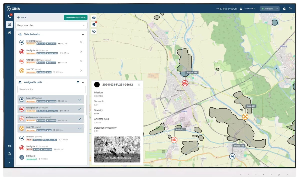
Clear satellite layers
Smart CAD displays processed satellite insights as simple map overlays that highlight fire hotspots, flooded regions or land movement. Responders get an immediate view of affected areas without interpreting raw imagery or switching tools.
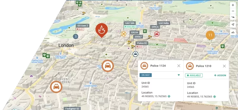
Connected communication
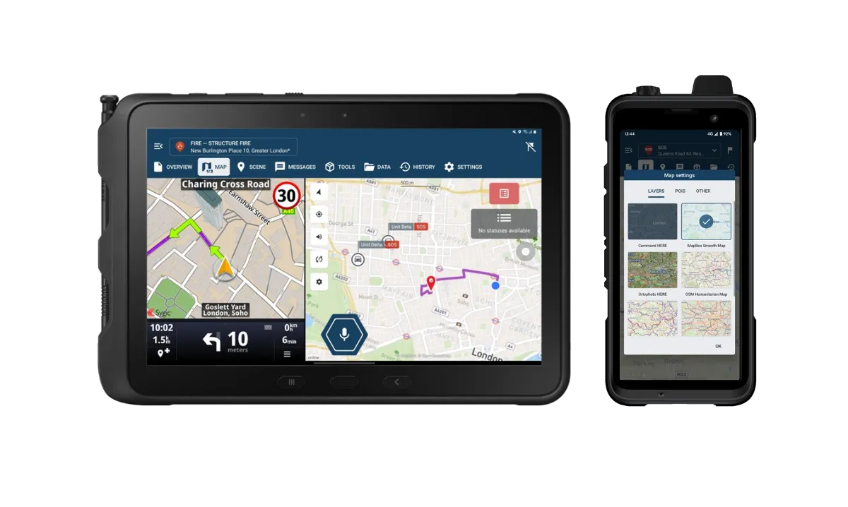
Status updates, multi-media sharing and push-to-talk keep teams connected throughout the operation. Field responders and command can exchange critical information instantly, which supports quick action when satellite insights show new risks.
Safe route planning
Smart CAD compares live unit locations with satellite identified risk zones and suggests the safest route based on current conditions. Teams can also set geofences around sensitive or hazardous areas, which trigger alerts when units move too close. This supports safer navigation and better control during fast changing operations.
Field ready access
GINA’s mobile apps deliver satellite enhanced information directly to field teams, along with live navigation, unit tracking and incident updates. The interface stays clear and focused, helping responders review conditions quickly, follow safe routes and stay aligned with the mission without distractions.

Shared operational picture
All agencies access the same satellite enhanced insights inside Smart CAD, from local responders to regional command. Shared situational awareness keeps decisions aligned and reduces communication gaps during complex missions.
Comprehensive reporting
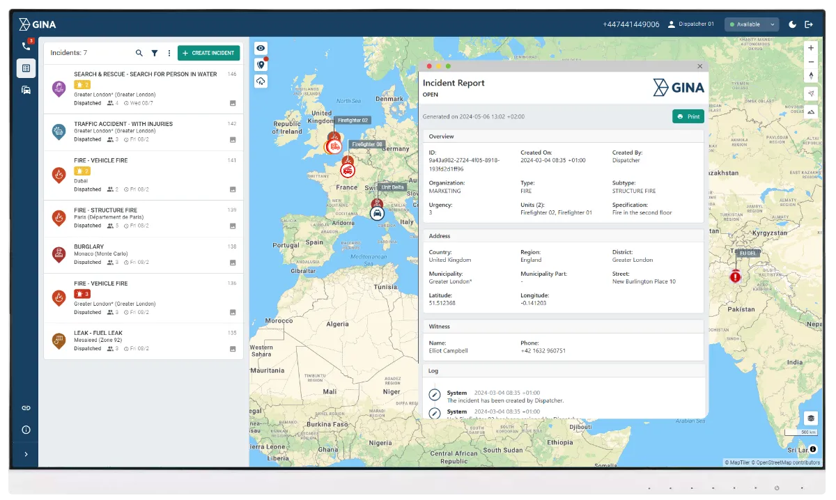
Smart CAD can generate clear reports that combine satellite updates, field activity and unit movements into one overview. Agencies gain a simple record of what happened, how conditions changed and how teams responded, which supports post-incident review and long term planning.
Tornado response supported by aerial mapping
After a tornado struck South Moravia, responders needed a fast overview of the affected area. GINA Software processed aerial imagery and created clear damage maps that highlighted blocked zones, destroyed structures and safe access routes. These visuals helped teams plan deployments and coordinate resources during the first critical hours.