

Table of Contents
GINA and the Czech Red Cross: Partnering for Impact
The cooperation between GINA and the Czech Red Cross (CRC) dates back to the COVID-19 pandemic. At that time, GINA solutions served as a key pillar in managing the unprecedented situation. They helped the Czech Red Cross monitor infections, manage resources, share data, track patients, and improve overall coordination.
Another notable deployment of GINA took place in 2023, when it helped the Czech Red Cross paramedics monitor the crowd during a reported rally. During this event, GINA enabled real-time coordination by providing commanders with a clear digital map overview, allowing them to dispatch teams efficiently, mark locations, and track movements throughout the intervention.
When destructive floods hit the Czech Republic in 2024, the CRC turned to GINA once again to ensure effective disaster response and coordination among the various teams involved, including volunteers, EMS and local authorities.
Facing the Challenge
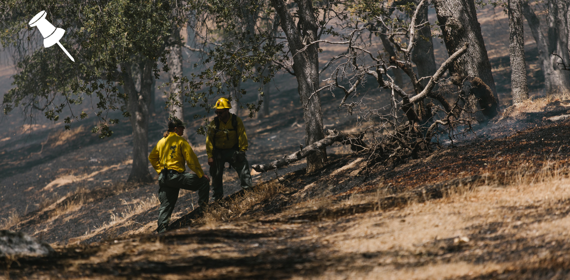
Floods that struck the eastern regions of the Czech Republic in 2024 directly affected hundreds of thousands of residents. Thousands were evacuated, while others faced power outages, property damage, and other flood-related hazards.
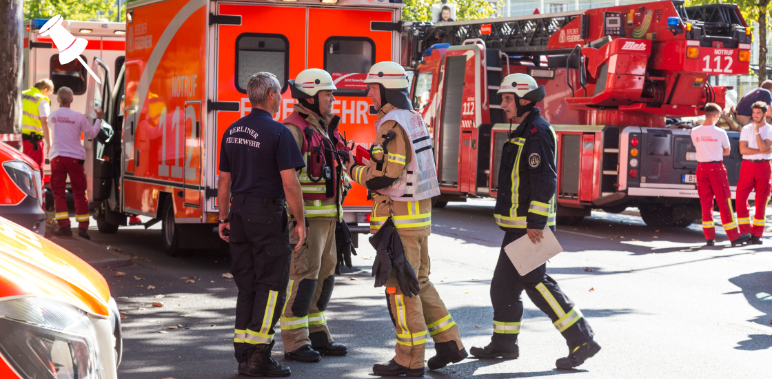
To combat the situation, the Czech Red Cross immediately mobilized its members and hundreds of volunteers to provide aid. The primary goal was to assist with emergency shelter, psychosocial support, basic medical care, and other forms of humanitarian relief.
As part of its response, the CRC:
- Deployed more than 1,200 volunteers.
- Established 11 evacuation centers.
- Provided disaster assistance, including psychosocial support, medical care, delivery of material aid, and other humanitarian services.
- Dispatched material aid to the affected areas.
Deployment
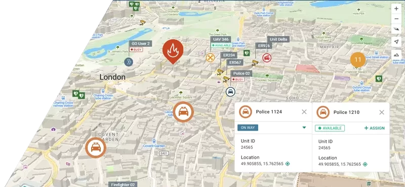
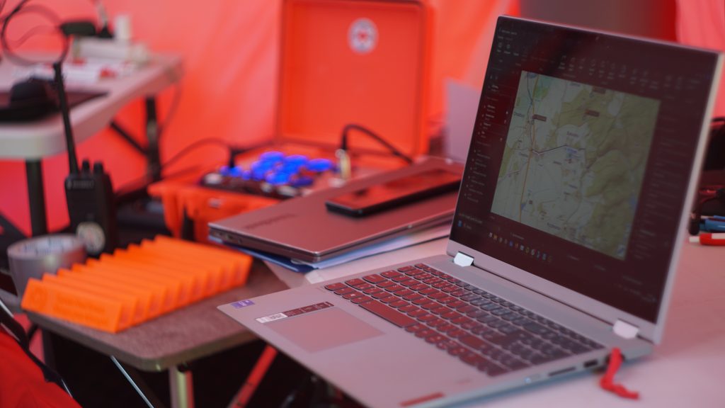
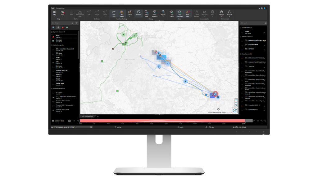
To ensure real-time situational awareness and effective coordination of many people involved, the CRC utilized GINA’s Tactical AVL in its operations centers and equipped field responders with the GINA GO mobile application.
Tactical AVL served as a central point for decision-making, thanks to its advanced mapping capabilities that displayed real-time unit positions, movements, and other critical information from the field.
GINA GO is a mobile app that provides field responders with fully digital workflows, from real-time location sharing and case reporting to multimedia exchange and digital form submission. Since it is easily downloadable from app stores and has a fast learning curve, it was quickly adopted by large numbers of volunteers, even those who joined the response operations for just one day.
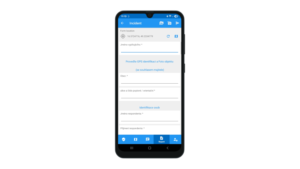
The setup, when GINA GO was installed on responders’ mobile devices and synced with the central system, brought the following benefits:
- Both commanders and field responders had a reliable channel for two-way information sharing.
- GINA’s digital workflows eliminated the need for pen and paper, saving valuable time.
- Operators were able to make situation-aware decisions, create geofences and incident drawings, marking key locations such as hazard zones, staging areas, and roadblocks, as well as drawing perimeters or evacuation zones for better orientation.
During the disaster and emergency coordination efforts, operations centers received information from field responders, for example, whether a doctor was available, whether the area was accessible, the presence of electricity, mobile signal, internet access, or requests for assistance.
For instance, when volunteers discovered that someone needed psychosocial support, they reported it to their commander, who checked the map and dispatched the right units to the location.
This level of control over response efforts also ensured that field crews did not duplicate work in areas that were already covered, while always staying informed about potential hazards and changing conditions.
“During the floods, GINA proved to be an essential part of our crisis management operations. It made decision-making faster and far more effective. Many of our members are volunteers, and GINA significantly contributes to their safety, which is a key aspect of incident response,” says Richard Smejkal, Crisis Resilience and Preparedness Lead, Czech Red Cross, Prague 1.
Impactful results
The combination of Tactical AVL and GINA GO significantly streamlined aid delivery and incident response in flood-affected areas, ultimately contributing to successful crisis management.
The deployment of GINA solutions as part of the crisis management infrastructure brought:
- Real-time visibility for command centers into the position and movement of field units via interactive map.
- Two-way communication and information sharing between commanders and field responders, including multimedia, on-site updates, assistance or intervention requests from people in distress, and even spiritual support.
- Fully digital workflows saved coordinators a lot of time, as they no longer had to retype data from paper forms into IT systems.
- Easy data sharing. Data was collected in standard formats and could be easily shared with other municipalities and stakeholders.
- Commanders could quickly create, modify, and adjust zones, and make informed decisions based on the evolving situation.
- Enhanced safety of responders. Responders had constant access to up-to-date information and had the ability to request help through the SOS button.